|
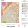
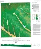
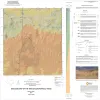
Geologic map of the Spice Rock quadrangle, Texas |
Elliott, Brent A. |
2015 |
Open-File Map |
|
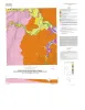
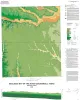
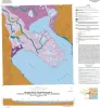
Geologic map of the Gainesville South quadrangle, Texas |
Collins, E.W. |
2015 |
Open-File Map |
|
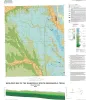
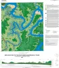
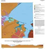
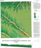
Geologic map of the Rincon Bend quadrangle, Aransas River and Copano Bay area, Texas Gulf of Mexico coast |
Paine, J.G., Collins, E.W., Costard, L. |
2015 |
Open-File Map |
|
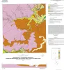
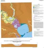
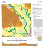
Geologic map of the Woodsboro quadrangle: Aransas and Mission Rivers, and Copano Bay area, Texas Gulf of Mexico Coast |
Paine, J.G., Collins, E.W., Costard, L. |
2015 |
Open-File Map |
|
Geologic map of the Muenster West quadrangle, Texas |
Collins, E.W. |
2015 |
Open-File Map |
|
Geologic map of the Pace Bend quadrangle, Texas |
Woodruff, C.M., Jr., Collins, E.W. |
2015 |
Open-File Map |
|
Geologic map of the Silver King Canyon quadrangle, Texas |
Elliott, Brent A. |
2015 |
Open-File Map |
|
Geologic map of the Hood quadrangle |
Collins, E.W. |
2014 |
Open-File Map |
|
Geologic map of the Travis Peak quadrangle |
Woodruff, C.M., Jr. |
2014 |
Open-File Map |
|
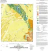
Geologic map of the Gunsight Hills South quadrangle, Texas |
Elliott, Brent A. |
2014 |
Open-File Map |
|
Geologic map of the Lasca quadrangle, Texas |
Elliott, Brent A. |
2014 |
Open-File Map |
|
Geologic map of the Losoya quadrangle, Texas |
Elliott, Brent A. |
2014 |
Open-File Map |
|
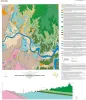
Geologic map of the Bayside quadrangle: Aransas Delta and Copano Bay Area, Texas Gulf of Mexico Coast |
Paine, J.G., Collins, E.W. |
2014 |
Open-File Map |
|
Geologic map of the Mission Bay quadrangle: Mission Delta and Copano Bay area, Texas Gulf of Mexico Coast |
Paine, J.G., Collins, E.W. |
2014 |
Open-File Map |
|
Geologic map of the Smithwick quadrangle, Texas |
Woodruff, C.M., Jr. |
2014 |
Open-File Map |
|
Geologic map of the Poteet quadrangle, Texas |
Elliott, Brent A. |
2013 |
Open-File Map |
|
Geologic map of the Thelma quadrangle, Texas |
Elliott, Brent A. |
2013 |
Open-File Map |
|
Geologic map the Muenster East quadrangle, Texas |
Collins, E.W. |
2013 |
Open-File Map |
|
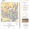
Geologic map of the Guadalupe delta, Texas Gulf of Mexico Coast: Sheet 1-Austwell quadrangle |
Paine, J.G., Collins, E.W. |
2013 |
Open-File Map |
|
Geologic map of the Guadalupe delta, Texas Gulf of Mexico Coast: Sheet 2-Bloomington SW quadrangle |
Collins, E.W., Paine, J.G. |
2013 |
Open-File Map |