|
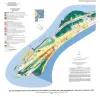
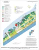
Geoenvironmental map of southwest Bolivar Peninsula, Bolivar and Flake quadrangles, Texas Gulf of Mexico Coast |
Tremblay, T.A., White, W.A., Waldinger, R.L., Collins, E.W. |
2007 |
Open-File Map |
|
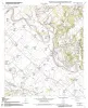
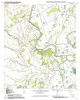
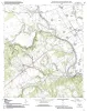
Geologic map of the Chances Store quadrangle, Texas |
Collins, E.W. |
2007 |
Open-File Map |
|
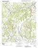
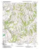
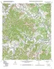
Geologic map of the Goodwill quadrangle, Texas |
Collins, E.W. |
2007 |
Open-File Map |
|
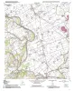
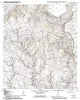
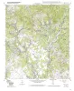
Geologic map of the Mumford quadrangle, Texas |
Collins, E.W. |
2007 |
Open-File Map |
|
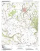
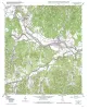
Geologic map of the Tunis quadrangle, Texas |
Collins, E.W. |
2007 |
Open-File Map |
|
Geologic map of the Bryan West quadrangle, Texas |
Collins, E.W. |
2007 |
Open-File Map |
|
Geologic map of the Hearne South quadrangle, Texas |
Collins, E.W. |
2006 |
Open-File Map |
|
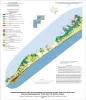
Geo-Environmental map of Northeast Galveston Island, Galveston quadrangle, Texas |
Tremblay, T.A., Gibeaut, J.C., Waldinger, R.L., White, W.A., Collins, E.W. |
2006 |
Open-File Map |
|
Geo-Environmental map of Central Galveston Island, Lake Como quadrangle, Texas |
Tremblay, T.A., Gibeaut, J.C., Waldinger, R.L., White, W.A., Collins, E.W. |
2006 |
Open-File Map |
|
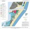
Geo-Environmental map of Southwest Galveston Island, San Luis Pass and Sea Isle quadrangles, Texas Gulf of Mexico |
Tremblay, T.A., Gibeaut, J.C., Waldinger, R.L., White, W.A., Collins, E.W. |
2006 |
Open-File Map |
|
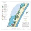
Geo-Environmental map of Northern Mustang Island, Port Aransas quadrangle, Texas Gulf of Mexico Coast |
Tremblay, T.A., Gibeaut, J.C., Waldinger, R.L., White, W.A., Collins, E.W. |
2006 |
Open-File Map |
|
Geo-Environmental map of Southern Mustang Island, Crane Islands NW quadrangle, Texas Gulf of Mexico Coast |
Tremblay, T.A., Gibeaut, J.C., Waldinger, R.L., White, W.A., Collins, E.W. |
2006 |
Open-File Map |
|
Geologic map of the Baileyville quadrangle, Texas |
Collins, E.W. |
2006 |
Open-File Map |
|
Geologic map of the Hammond quadrangle, Texas |
Collins, E.W. |
2006 |
Open-File Map |
|
Geologic map of the Maysfield quadrangle, Texas |
Collins, E.W. |
2006 |
Open-File Map |
|
Geologic map of the Calvert quadrangle, Texas |
Collins, E.W. |
2006 |
Open-File Map |
|
Geologic map of the Gause quadrangle, Texas |
Collins, E.W. |
2006 |
Open-File Map |
|
Geologic map of the A Bar A quadrangle, Texas |
Collins, E.W. |
2004 |
Open-File Map |
|
Geologic map of the Bandera Pass quadrangle, Texas |
Collins, E.W. |
2004 |
Open-File Map |
|
Geologic map of the Center Point quadrangle, Texas |
Collins, E.W. |
2004 |
Open-File Map |