|
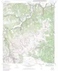
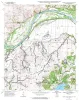
Geologic map of the Coupland quadrangle, Texas |
Collins, E.W. |
2000 |
Open-File Map |
|
Geologic map of the Trio quadrangle, Texas |
Collins, E.W. |
2000 |
Open-File Map |
|
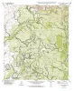
Geologic map of the Elgin East Quadrangle, Texas |
Collins, E.W. |
2000 |
Open-File Map |
|
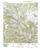
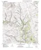
Geologic map of the Utopia quadrangle, Texas |
Collins, E.W. |
2000 |
Open-File Map |
|
Geologic map of the Elgin West Quadrangle, Texas |
Collins, E.W. |
2000 |
Open-File Map |
|
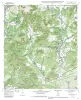
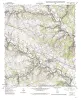
Geologic map of the Vanderpool quadrangle, Texas |
Collins, E.W. |
2000 |
Open-File Map |
|
Geologic map of the Lake Bastrop Quadrangle, Texas |
Collins, E.W. |
2000 |
Open-File Map |
|
Geologic map of the Comanche Waterhole quadrangle, Texas |
Collins, E.W. |
1999 |
Open-File Map |
|
Geologic map of the Briggs quadrangle, Texas |
Collins, E.W. |
1999 |
Open-File Map |
|
Geologic map of the Nameless Quadrangle, Texas |
Collins, E.W. |
1999 |
Open-File Map |
|
Geologic map of the Flat Rock Crossing Quadrangle, Texas |
Collins, E.W. |
1999 |
Open-File Map |
|
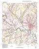
Geologic map of the Luling quadrangle, Texas |
Collins, E.W. |
1999 |
Open-File Map |
|
Geologic map of the Prairie Valley School quadrangle, Texas |
Collins, E.W. |
1999 |
Open-File Map |
|
Geologic map of the Mahomet Quadrangle, Texas |
Collins, E.W. |
1999 |
Open-File Map |
|
Geologic map of the Flat Rock Creek SW quadrangle, Texas |
Collins, E.W. |
1999 |
Open-File Map |
|
Geologic map of the Liberty Hill Quadrangle, Texas |
Collins, E.W. |
1999 |
Open-File Map |

|
Geologic map of the Mud Creek North quadrangle, Texas |
Collins, E.W. |
1999 |
Open-File Map |
|
Geologic map of the Mud Creek South quadrangle, Texas |
Collins, E.W. |
1999 |
Open-File Map |
|
Geologic map of the Sabinal quadrangle, Texas |
Collins, E.W. |
1999 |
Open-File Map |
|
Geologic map of the Magers Crossing Quadrangle, Texas |
Collins, E.W. |
1999 |
Open-File Map |