Publications in Travis
| Title | Publication Year Sort ascending | Abstract | Author | Series | Publisher | |
|---|---|---|---|---|---|---|

|
History of Geology at The University of Texas | 1967 | This history of geology at The University of Texas was prepared for the dedication of the new Geology Building, November 1967. It is a brief history; many details have been omitted. The names of most graduates and some faculty will not be found. |
Young, Keith | Geological Circular | Bureau of Economic Geology |
|
Stratigraphy of the Fredericksburg Division, south-central Texas | 1964 | Sediments of the Fredericksburg Division in south-central Texas were deposited on the slowly subsiding west flank of the Tyler basin. In this region there are three stratigraphically distinct areas. The southern area has a thick Edwards Limestone unit overlying a thin Walnut Formation. |
Moore, C.H. | Report of Investigations | Bureau of Economic Geology |

|
Mineral resources of the Colorado River Industrial Development Association area | 1958 | The Colorado River Industrial Development Association area consists of ten counties [Bastrop, Blanco, Burnet, Colorado, Fayette, Llano, Matagorda, San Saba, Travis, and Wharton counties] in the lower watershed of Colorado River in Texas. |
Dietrich, J.W., Lonsdale, J.T. | Report of Investigations | Bureau of Economic Geology |

|
Field excursion, eastern Llano region | 1958 | The first entry in the Guidebook Series details a field excursion to the Eastern Llano Region of Central Texas in 1958. Retrace the footsteps of Virgil Barnes and the other state geologists in attendance: Stop 1. Honeycut Bend |
Barnes, V.E. | Guidebook | Bureau of Economic Geology |
|
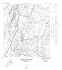
Geologic Maps, Central Texas (selected areas), 1957 and 1959 | 1957 | Fourteen black-and-white geologic maps prepared in 1957 and 1959 and obtained from the Department of Geological Sciences, University of Texas, and sold by the Bureau of Economic Geology. Geology compiled by F. L. Whitney; drafted by S. Espey, W. M. Strong, or W. L. Brooks; edited by K. P. |
Whitney, F.L. | Miscellaneous Map | Bureau of Economic Geology |
| |
Map showing correlation of geologic, gravity, and magnetic observations, Blanco and Gillespie Counties, Texas | 1955 | Barnes, V.E., Romberg, Frederick, Anderson, W.A. | Miscellaneous Map | Bureau of Economic Geology | |
|
The Carboniferous Rocks of the Llano Region of Central Texas | 1950 | Plummer, F.B. | UT Publication | ||
|
Ouachita facies in central Texas | 1948 | Steeply dipping shales and interbedded sandstones presumably of the Ouachita facies have been discovered along the Colorado River in Burnet and Travis counties, Texas. Previously the Ouachita facies was known in Texas only from bore-hole samples. |
Barnes, V.E. | Report of Investigations | Bureau of Economic Geology |
|
Building Stones of Central Texas | 1942 | Barnes, V.E., Dawson, R.F., Parkinson, G.A. | UT Publication | ||
|
Report on the Mineral Resources of Travis County, Texas | 1941 | The information contained in this circular was gathered by a unit of the WPA Mineral Resource Survey of Texas, a project sponsored by The University of Texas at Austin, Bureau of Economic Geology. |
Nickell, C.O. | Mineral Resource Survey Circulars |