|
The Carboniferous Rocks of the Llano Region of Central Texas |
1950 |
|
Plummer, F.B. |
UT Publication |
|
|
Clay Deposits of the Cisco Group of North-Central Texas |
1949 |
|
Plummer, F.B., Bradley, H.B., Pence, F.K. |
UT Publication |
|
|
Progress Report on Peat Deposits in Texas |
1945 |
|
Plummer, F.B. |
Mineral Resource Circular |
Bureau of Economic Geology |

|
Limestones in central Texas suitable for the manufacture of rock wool |
1944 |
|
Plummer, F.B. |
Mineral Resource Circular |
Bureau of Economic Geology |
|
A New Quartz Sand Horizon in the Cambrian of Mason County, Texas |
1942 |
|
Plummer, F.B. |
Mineral Resource Circular |
Bureau of Economic Geology |
|
Peat Deposits in Texas |
1941 |
|
Plummer, F.B. |
Mineral Resource Circular |
Bureau of Economic Geology |
|
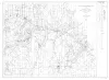
Geologic map of San Saba County, Texas, south of 31 degrees 21minutes latitude |
1940 |
|
Plummer, F.B. |
Miscellaneous Map |
Bureau of Economic Geology |
|
Summary of Progress on Geology and Oil Shale Investigation in San Saba County |
1940 |
|
Plummer, F.B. |
Mineral Resource Circular |
Bureau of Economic Geology |
|
The Geology of Texas, v. III, Upper Paleozoic Ammonites and Fusulinids; Part 1, Upper Paleozoic Ammonites in Texas [and] Part 2, Permian Fusulinidae of Texas |
1937 |
|
Plummer, F.B., Scott, Gayle, Dunbar, C.O., Skinner, J.W. |
UT Bulletin |
|
|
Geology of Palo Pinto County, Texas |
1936 |
|
Plummer, F.B., Hornberger, Joseph, Jr. |
UT Bulletin |
|