Publications in Travis
| Title | Publication Year Sort ascending | Abstract | Author | Series | Publisher | |
|---|---|---|---|---|---|---|
|
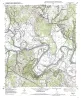
Geologic map of the Utley Quadrangle, Texas | 2000 | Collins, E.W. | Open-File Map | Bureau of Economic Geology | |
|
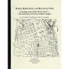
Rocks, Resources, and Recollections, A Geologic Tour of the "Forty Acres" - The University of Texas at Austin Campus | 1999 | Woodruff, C.M., Jr., Kirkland, Brenda L. | Austin Geological Society | Austin Geological Society | |
|
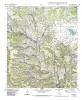
Geologic map of the Nameless Quadrangle, Texas | 1999 | Collins, E.W. | Open-File Map | Bureau of Economic Geology | |
|
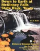
Down to earth at McKinney Falls State Park, Texas | 1997 | Written in an informal style for a nontechnical audience, this guide summarizes geologic features and history of McKinney Falls State Park, just south of Austin, Texas. |
Raney, J.A. | Down To Earth | Bureau of Economic Geology |
|
The dimension stone industry of Texas | 1992 | Garner, L.E. | Mineral Resource Circular | Bureau of Economic Geology | |
|
Water Quality Issues for Barton Creek and Barton Springs | 1991 | Johns, D.A., Heathman, Tom, Lyday, Mike, McClintock, Nancy, Stecher, Steve, Barton Springs Task Force | Austin Geological Society | Austin Geological Society | |
|
Hydrogeology of Edwards Aquifer-Barton Springs Segment, Travis and Hays Counties, Texas | 1984 | Woodruff, C.M., Jr., Slade, Raymond M., Jr. | Austin Geological Society | Austin Geological Society | |
|
Hydrogeology of the Edwards aquifer, Austin area, central Texas | 1984 | The Edwards Formation, on the downthrown side of Mt. Bonnell fault in the Austin, Texas, area (Hays and Travis Counties), is part of the northeastern extension of the Edwards Underground Reservoir, the primary source of water in numerous counties along the Balcones Fault Zone. |
Senger, R.K., Kreitler, C.W. | Report of Investigations | Bureau of Economic Geology |
|
Geology of the Spicewood Quadrangle, Blanco, Burnet, and Travis Counties, Texas | 1982 | Barnes, V.E. | Geologic Quadrangle Map | Bureau of Economic Geology | |

|
Geology of the Hammetts Crossing Quadrangle, Blanco, Hays, and Travis Counties, Texas | 1982 | Barnes, V.E. | Geologic Quadrangle Map | Bureau of Economic Geology |