|
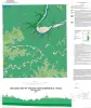
Geologic map of the Bee Cave quadrangle, Texas |
2016 |
|
Collins, E.W. |
Open-File Map |
Bureau of Economic Geology |
|
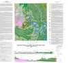
Geologic map of the upper Lake Travis area, Texas |
2016 |
|
Woodruff, C.M., Jr., Collins, E.W. |
Miscellaneous Map |
Bureau of Economic Geology |
|
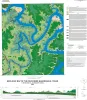
Geologic map of the Pace Bend quadrangle, Texas |
2015 |
|
Woodruff, C.M., Jr., Collins, E.W. |
Open-File Map |
Bureau of Economic Geology |
|
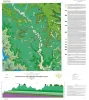
Geologic map of the Travis Peak quadrangle |
2014 |
|
Woodruff, C.M., Jr. |
Open-File Map |
Bureau of Economic Geology |
|
Volcanic Features of the Austin Area, Texas |
2006 |
|
Caran, S.C., Housh, Todd, Cherepon, Alan J. |
Austin Geological Society |
Austin Geological Society |
|
Geologic map of the west half of the Taylor, Texas, 30 X 60 minute quadrangle: central Texas urban corridor, encompassing Round Rock, Georgetown, Salado, Briggs, Liberty Hill, and Leander |
2005 |
|
Collins, E.W. |
Miscellaneous Map |
Bureau of Economic Geology |
|
Geologic map of the Dripping Springs quadrangle, Texas |
2002 |
|
Collins, E.W. |
Open-File Map |
Bureau of Economic Geology |
|
Geologic map of the Shingle Hills quadrangle, Texas |
2002 |
|
Collins, E.W. |
Open-File Map |
Bureau of Economic Geology |
|
Geologic map of the Coupland quadrangle, Texas |
2000 |
|
Collins, E.W. |
Open-File Map |
Bureau of Economic Geology |
|
Geologic map of the Elgin West Quadrangle, Texas |
2000 |
|
Collins, E.W. |
Open-File Map |
Bureau of Economic Geology |