Publications in Matagorda
| Title | Publication Year Sort ascending | Abstract | Author | Series | Publisher | |
|---|---|---|---|---|---|---|
|
Geochemistry of bottom sediments -- Matagorda Bay system, Texas | 1979 | Approximately 800 sediment samples from stream beds and bay bottoms of water bodies that compose the Matagorda Bay system were collected and analyzed. Shell-sand-mud ratios and total organic carbon content were determined, and 20 trace elements were detected. |
McGowen, J.H., Byrne, J.R., Wilkinson, B.H. | Geological Circular | Bureau of Economic Geology |
|
Historical Shoreline Changes and Their Causes, Texas Gulf Coast | 1977 | Sequential shoreline monitoring, using vintage chans and aerial photographs, documents temporal and spatial variations in historical Gulf shoreline changes. |
Morton, R.A. | Geological Circular | Bureau of Economic Geology |
|
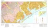
Environmental geologic Atlas of the Texas coastal zone -- Port Lavaca area | 1976 | The Texas Coastal Zone is marked by diversity in geography, resources, climate, and industry. |
McGowen, J.H., Proctor, C.V., Jr., Brown, L.F., Jr., Evans, T.J., Fisher, W.L., Groat, C.G. | Environmental Geologic Atlas of the Texas Coastal Zone | Bureau of Economic Geology |
|
Environmental geologic Atlas of the Texas coastal zone -- Bay City-Freeport area | 1976 | The Texas Coastal Zone is marked by diversity in geography, resources, climate, and industry. |
McGowen, J.H., Brown, L.F., Jr., Evans, T.J., Fisher, W.L., Groat, C.G. | Environmental Geologic Atlas of the Texas Coastal Zone | |
|
Shoreline changes on Matagorda Peninsula (Brown Cedar Cut to Pass Cavallo) -- an analysis of historical changes of the Texas Gulf shoreline | 1976 | Historical monitoring along Matagorda Peninsula from Brown Cedar Cut to Pass Cavallo records the nature and magnitude of changes in position of the shoreline and vegetation line and provides insight into the factors affecting those changes. |
Morton, R.A., Pieper, M.J., McGowen, J.H. | Geological Circular | Bureau of Economic Geology |
|
Geothermal Resources of the Texas Gulf Coast: Environmental Concerns Arising from the Production and Disposal of Geothermal Waters | 1976 | Disposal and temporary surface storage of spent geothermal fluids and surface subsidence and faulting are the major environmental problems that could arise from geopressured geothermal water production. |
Gustavson, T.C., Kreitler, C.W. | Geological Circular | Bureau of Economic Geology |
|
Historical changes and related coastal processes, Gulf and mainland shorelines, Matagorda Bay area, Texas | 1975 | Change, both natural and man-induced, is a significant and defining element of the Coastal Zone. Man-induced change, by definition, can be controlled if desired. |
McGowen, J.H., Brewton, J.L. | Selected Reports | Bureau of Economic Geology |
|
Geologic Atlas of Texas, Beeville-Bay City sheet (revised 1987) | 1975 | Geologic map that depicts the surface geology of Goliad, Refugio, and Calhoun Counties and parts of Karnes, De Witt, Victoria, Jackson, Matagorda, Aransas, San Patricio, Bee, and Live Oak Counties. The 4-page booklet indicates geologic formations, abbreviations, and ages. |
Barnes, V.E., Brown, T.E., Brewton, J.L., Aronow, Saul, Eargle, D.H., Morton, R.G., Maxson, M.J., Wyeth, J.C. | Geologic Atlas of Texas | Bureau of Economic Geology |
|
Shoreline changes in the vicinity of Brazos River delta (San Luis Pass to Brown Cedar Cut) -- an analysis of historical changes of the Texas Gulf shoreline | 1975 | Historical monitoring in the vicinity of the Brazos River delta (San Luis Pass to Brown Cedar Cut) records the nature and magnitude of changes in position of the shoreline 'and vegetation line and provides insight into the factors affecting those changes. |
Morton, R.A., Pieper, M.J. | Geological Circular | Bureau of Economic Geology |
|
Geothermal resources, Frio Formation, middle Texas Gulf coast | 1975 | Knowledge of the regional sand distribution and its relationship to formation temperature and pressure is a preliminary step in evaluating the geothermal resources of the Frio Formation. |
Bebout, D.G., Agagu, O.K., Dorfman, M.H. | Geological Circular | Bureau of Economic Geology |