Publications in Matagorda
| Title | Publication Year Sort ascending | Abstract | Author | Series | Publisher | |
|---|---|---|---|---|---|---|
|
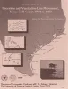
Shoreline and vegetation-line movement, Texas Gulf coast, 1974 to 1982 | 1989 | The purposes of this study were (1) to quantify recent (1974 to 1982) movement of Texas shorelines and vegetation lines by analysis of aerial photographs; (2) to place this movement in historical (pre-1974) context; and (3) to examine the influence of environmental variables such as storms, sea l |
Paine, J.G., Morton, R.A. | Geological Circular | Bureau of Economic Geology |
|
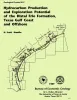
Hydrocarbon production and exploration potential of the distal Frio Formation, Texas Gulf coast and offshore | 1989 | Along the Texas Gulf shoreline and offshore, the distal margin of the Frio Formation is a deep hydrocarbon province that is underexplored relative to the onshore Frio. |
Hamlin, H.S. | Geological Circular | Bureau of Economic Geology |

|
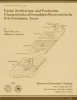
Submerged lands of Texas, Bay City - Freeport area: sediments, geochemistry, benthic macroinvertebrates, and associated wetlands | 1988 | The State-owned submerged lands of Texas encompass almost 6,000 mi2 (15,540 km2). They lie below waters of the bay-estuary-lagoon system and the Gulf of Mexico and extend 10.3 mi (16.6 km) seaward from the Gulf shoreline (fig. 1). |
White, W.A., Calnan, T.R., Morton, R.A., Kimble, R.S., Littleton, T.G., McGowen, J.H., Nance, H.S. | Submerged Lands of Texas | Bureau of Economic Geology |
|
Facies architecture and production characteristics of strand-plain reservoirs in the Frio Formation, Texas | 1985 | Many modern shore zones comprise a continuum of depositional environments that encompass both strandplain and barrier-island systems. Strandplains are further subdivided into two classes: sand-rich beach-ridge plains and mud-rich chenier plains. |
Tyler, Noel, Ambrose, W.A. | Report of Investigations | Bureau of Economic Geology |
|
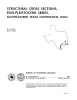
Structural cross sections, Miocene series, Texas continental shelf | 1985 | These cross sections numerically correspond to previously published onshore cross sections (CS0002--Dodge and Posey, 1981) and extend those sections across the continental shelf into the Miocene, a recent target of renewed petroleum exploration. |
Morton, R.A., Jirik, L.A., Foote, R.Q. | Cross Sections | Bureau of Economic Geology |
|
Upper Tertiary and Quaternary depositional systems, central coastal plain, Texas -- regional geology of the coastal aquifer and potential liquid-waste repositories | 1981 | Upper Miocene, Pliocene, and Pleistocene deposits in the subsurface of the central Coastal Plain of Texas were subdivided into six operational units comprising the surface-defined Fleming, Goliad, Willis, Lissie, and Beaumont Formations. |
Solis-Iriarte, R.F. | Report of Investigations | Bureau of Economic Geology |

|
Structural cross sections, Tertiary formations, Texas Gulf Coast | 1981 | The publication comprises 24 structural dip cross sections, spaced 15 to 20 mi apart along the Texas coast, and 4 structural strike cross sections. Dip sections extend from near the Wilcox outcrop to the coastline. |
Dodge, M.M., Posey, J.S. | Cross Sections | Bureau of Economic Geology |
|
Importance of Secondary Leached Porosity in Lower Tertiary Sandstone Reservoirs along the Texas Gulf Coast | 1980 | Secondary leached porosity is common to dominant in near surface to deep subsurface lower Tertiary sandstone reservoirs along the Texas Gulf Coast. This secondary porosity is in the form of leached feldspar grains, volcanic rock fragments, carbonate cements, and carbonate-replaced grains. |
Loucks, R.G., Dodge, M.M., Galloway, W.E. | Geological Circular | Bureau of Economic Geology |

|
Depositional patterns of Miocene facies, middle Texas coastal plain | 1979 | Doyle, J.D. | Report of Investigations | Bureau of Economic Geology | |
|
Geochemistry of bottom sediments -- Matagorda Bay system, Texas | 1979 | Approximately 800 sediment samples from stream beds and bay bottoms of water bodies that compose the Matagorda Bay system were collected and analyzed. Shell-sand-mud ratios and total organic carbon content were determined, and 20 trace elements were detected. |
McGowen, J.H., Byrne, J.R., Wilkinson, B.H. | Geological Circular | Bureau of Economic Geology |