Publication Search

Publications in Hudspeth

Title Publication Year Sort ascending Abstract Author Series Publisher
Geologic map of the Fort Hancock NW quadrangle, Texas Geologic map of the Fort Hancock NW quadrangle, Texas 1996 Collins, E.W. Open-File Map Bureau of Economic Geology
Geologic map of the McNary quadrangle, Texas Geologic map of the McNary quadrangle, Texas 1996 Collins, E.W. Open-File Map Bureau of Economic Geology
Geologic map of the Padre Canyon quadrangle, Texas Geologic map of the Padre Canyon quadrangle, Texas 1996 Collins, E.W. Open-File Map Bureau of Economic Geology
Geologic map of the T P Well quadrangle, Texas Geologic map of the T P Well quadrangle, Texas 1996 Collins, E.W. Open-File Map Bureau of Economic Geology
Sequence hierarchy and facies architecture of a carbonate-ramp system:  San Andres Formation of Algerita Escarpment and western Guadalupe Mountains, West Texas and New Mexico Sequence hierarchy and facies architecture of a carbonate-ramp system: San Andres Formation of Algerita Escarpment and western Guadalupe Mountains, West Texas and New Mexico 1995

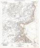
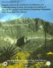
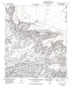
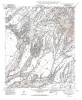
This study offers a high-frequency sequence stratigraphic model of carbonate-ramp strata of the San Andres Formation.

Kerans, Charles, Fitchen, W.M. Report of Investigations Bureau of Economic Geology
Geologic map of the Diablo Canyon West quadrangle, Texas Geologic map of the Diablo Canyon West quadrangle, Texas 1994 Collins, E.W., Raney, J.A. Open-File Map Bureau of Economic Geology
Geologic map of the Campo Grande Mountain quadrangle, Texas Geologic map of the Campo Grande Mountain quadrangle, Texas 1994 Collins, E.W., Raney, J.A. Open-File Map Bureau of Economic Geology
Geologic map of the Cavett Lake quadrangle, Texas Geologic map of the Cavett Lake quadrangle, Texas 1994 Collins, E.W. Open-File Map Bureau of Economic Geology
Geologic map of the Fort Hancock quadrangle, Texas Geologic map of the Fort Hancock quadrangle, Texas 1994 Collins, E.W., Raney, J.A. Open-File Map Bureau of Economic Geology
Hydrogeologic investigations of deep ground-water flow in the Chihuahuan Desert, Texas Hydrogeologic investigations of deep ground-water flow in the Chihuahuan Desert, Texas 1992

Regional and local hydrologic investigations were conducted in Trans-Pecos Texas as part of a study to evaluate potential sites for a low-level radioactive waste repository.

Mullican, W.F., Senger, R.K. Report of Investigations Bureau of Economic Geology