Publications in Burnet
| Title | Publication Year Sort ascending | Abstract | Author | Series | Publisher | |
|---|---|---|---|---|---|---|
|
Land resource overview of the Capital Area Planning Council Region, Texas -- a nontechnical guide | 1979 | Bastrop, Blanco, Burnet, Caldwell, Fayette, Hays, Lee, Llano, Travis, and Williamson Counties make up the Capital Area Planning Council (CAPCO) region in Central Texas (fig. 1). The region covers 8,427 square miles (21,826 km2) and includes land of great physical diversity. |
Woodruff, C.M., Jr. | Selected Reports | Bureau of Economic Geology |
|
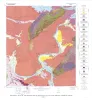
Geology of the Dunman Mountain Quadrangle, Llano, Burnet, and Blanco Counties, Texas | 1978 | Barnes, V.E. | Geologic Quadrangle Map | Bureau of Economic Geology | |
|
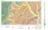
Geologic map of the Round Mountain quadrangle, Blanco, Burnet, and Llano counties. Texas | 1978 | Barnes, V.E. | Geologic Quadrangle Map | Bureau of Economic Geology | |
|
The Moore Hollow Group of central Texas | 1977 | Middle and Upper Cambrian rocks and locally up to 90 feet of Lower Ordovician rocks in Central Texas, are here named the Moore Hollow Group. |
Barnes, V.E., Bell, W.C. | Report of Investigations | |
|
Geology of the Kingsland Quadrangle, Llano and Burnet Counties, Texas | 1976 | Barnes, V.E. | Geologic Quadrangle Map | Bureau of Economic Geology | |

|
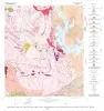
Geologic Atlas of Texas, Brownwood sheet | 1976 | Geologic map that depicts the surface geology of Mills County and parts of Runnels, Coleman, Brown, Comanche, Erath, Hamilton, Coryell, Lampasas, San Saba, McCulloch, Concho, and Menard Counties. The 21-page booklet indicates geologic formations, abbreviations, and ages. |
Kier, R.S., Harwood, P., Brown, L.F., Jr., Goodson, J.L., Barnes, V.E., Shell Oil Co., Humble Oil and Refining Co., Southern Minerals Corp. | Geologic Atlas of Texas | Bureau of Economic Geology |
|
Land capability in the Lake Travis vicinity, Texas -- a practical guide for the use of geologic and engineering data | 1975 | The Lake Travis vicinity lies predominantly within a carbonate rock terrane and is the site of ongoing intensive residential development. |
Woodruff, C.M., Jr. | Report of Investigations | Bureau of Economic Geology |
|
Geologic Atlas of Texas, Austin sheet | 1974 | Geologic map that depicts the surface geology of Burleson, Lee, Washington, and Brazos Counties and parts of Burnet, Bell, Milam, Robertson, Madison, Grimes, Waller, Austin, Fayette, Bastrop, Caldwell, Hays, Travis, and Williamson Counties. |
Barnes, V.E., Shell Oil Co., Humble Oil and Refining Co., Mobil Oil Co., Proctor, C.V., Jr., Brown, T.E., McGowen, J.H., Waechter, N.B. | Geologic Atlas of Texas | Bureau of Economic Geology |
|
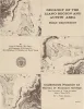
Geology of the Llano region and Austin area: field excursion | 1972 | This Guidebook represents an updating of Bureau of Economic Geology Guidebook No. 5, Field Excursion-Geology of Llano Region and Austin Area. It also represents a modification of Geology of the Llano Region and Austin Area, Texas, published by the Shreveport Geological Society in 1971. |
Barnes, V.E., Bell, W.C., Clabaugh, S.E., Cloud, P.E., Jr., McGehee, R.V., Rodda, P.U., Young, Keith | Guidebook | Bureau of Economic Geology |
|
Stratigraphy of Lower Cretaceous Trinity deposits of central Texas | 1971 | The stratigraphic record of the Lower Cretaceous Trinity Division in Central Texas, as revealed by extensive outcrop investigation, is that of a shallow sea transgressing the southern flank of the ancient Llano Uplift. |
Stricklin, F.L., Smith, C.I., Lozo, F.E. | Report of Investigations | Bureau of Economic Geology |