|
Geologic map of the A Bar A quadrangle, Texas |
2004 |
|
Collins, E.W. |
Open-File Map |
Bureau of Economic Geology |
|
Geologic map of the Bandera Pass quadrangle, Texas |
2004 |
|
Collins, E.W. |
Open-File Map |
Bureau of Economic Geology |
|
Geologic map of the Center Point quadrangle, Texas |
2004 |
|
Collins, E.W. |
Open-File Map |
Bureau of Economic Geology |
|
Geologic map of the Echo Hill Ranch quadrangle, Texas |
2004 |
|
Collins, E.W. |
Open-File Map |
Bureau of Economic Geology |
|
Geologic map of the Fall Creek quadrangle, Texas |
2004 |
|
Collins, E.W. |
Open-File Map |
Bureau of Economic Geology |
|
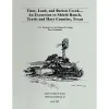
Time, Land, Barton Creek-- An Excursion to Shield Ranch, Travis and Hays Counties, Texas |
2003 |
|
Woodruff, C.M., Jr., Collins, E.W. |
Austin Geological Society |
Austin Geological Society |
|
Geologic map of the Seymour aquifer deposits, Vernon, Texas 30x60 minute quadrangle, Texas |
2003 |
|
Collins, E.W. |
Open-File Map |
Bureau of Economic Geology |
|
Geologic map of the Cypress Creek quadrangle, Texas |
2002 |
|
Collins, E.W. |
Open-File Map |
Bureau of Economic Geology |
|
Geologic map of the Driftwood quadrangle, Texas |
2002 |
|
Collins, E.W. |
Open-File Map |
Bureau of Economic Geology |
|
Geologic map of the Crabapple Creek quadrangle, Texas |
2002 |
|
Collins, E.W. |
Open-File Map |
Bureau of Economic Geology |