Coal is found in six areas in Texas, including the large North-Central Texas field, a distinctive cannel coalfield in Webb County, and Late Cretaceous-age coals near Eagle Pass. Throughout the state coal occurs in thin beds (rarely more than 3 ft thick) under overburden of varying thickness and degrees of consolidation and is generally high-volatile C bituminous coal.
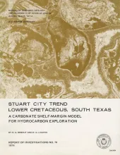
Lower Cretaceous shallow-water carbonates accumulated on a broad shelf which completely encircled the Gulf of Mexico. Biogenic growth climaxed along the basinward edge, or shelf margin, where a complex of reefs, banks, bars, and islands developed. The sediments reached a total thickness of 2,000 to 2,500 feet; numerous deep wells ranging in total depth from 11,000 to 20,000 feet have resulted in the discovery of a few marginally productive gas fields.
The stratigraphic record yields evidence that each episode of clastic silicate deposition has been of limited duration and that each has been preceded and followed by a significant hiatus. Evidence for alternations of deposition and nondeposition is readily apparent in the landward portions of Pleistocene deposits along the Gulf Coast, due to the glacio-eustatic changes in sea level; evidence of alternations, although elusive, exists also in the basinward portions of these deposits.
Historical monitoring along Galveston Island records the type and magnitude of changes in position of the shoreline and vegetation line and provides insight into the factors affecting those changes. Documentation of changes is aided by the compilation of shoreline and vegetation line position from topographic maps, aerial photographs, and coastal charts of various vintages.