Publication Year
1976
Publisher
Series
Report of Investigations
Abstract
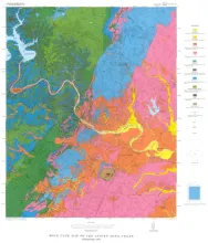
Over 7,000 miles of lineations have been observed on aerial photographic mosaics of the Texas Coastal Zone. These lineations, in part, represent the surface traces of faults originating in the Tertiary sediments and propagating through the Quaternary sediments. The extrapolation of subsurface faults from specific oil and gas reservoirs are commonly coincident to lineations in those areas. Some extrapolated fault traces weave back and forth across lineations for 10 to 20 miles and then coincide with another lineation and follow it for 20 miles.
Publication Year
1976
Publisher
Series
Miscellaneous Map
Publication Year
1976
Publisher
Series
Mineral Resource Circular
Publication Year
1976
Publisher
Series
Geologic Quadrangle Map
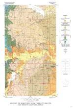
Publication Year
1976
Publisher
Series
Geologic Quadrangle Map