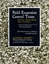
The departure point of the Villa Capri Motor Hotel may be gone, but the geologic information within Guidebook Number 3 remains relevant to this day: "The four stops of this field trip are in the Upper Eocene (Jackson) and Oligocene volcanic ash and bentonite beds, which crop out about 50 miles southeast of Austin. In the road log, the geology of the area between Austin and these volcanic beds is only briefly noted.
Three mappable members in the upper part of the Thrifty formation (Blach Ranch limestone, unnamed shale, and Breckenridge limestone), two in the lower part of the overlying Harpersville formation (Quinn clay and Crystal Falls limestone), and six minor lentils, all in the outcropping Cisco group, northern Stephens County, Texas, have been mapped and are described. The Blach Ranch, Breckenridge, and Crystal Falls limestone members, which are important regional stratigraphic markers in surface Cisco rocks of the Brazos Valley, have been redescribed at type localities in the area.
Almost everyone has seen the fossilized remains of prehistoric plants or animals. These might have been the skeleton of a gigantic dinosaur, the petrified trunk of an ancient tree, or the shells of snails or oysters that lived in the great seas that covered Texas millions of years ago. Each year more and more people are learning that these fossils are more than mere curiosities. Instead, they are realizing that a good collection of fossils provides much information about the early history of our earth, and that fossil collecting can be a most enjoyable, fascinating, and rewarding hobby.
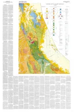
About 10 miles south of Van Horn, Texas, the Van Horn Mountains rise abruptly above an intermontane plain and extend southward to the Sierra Vieja. The area lies primarily in the southwestern part of Culberson County but extends into Hudspeth and Jeff Davis counties. The mountains owe their present topographic form to late Tertiary block-faulting. Structurally, they are a northward-trending horst which is flanked on the east and west by intermontane basins.


