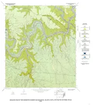
San Andres oil constitutes more than 80 percent of the total production from the Northern Shelf of the Midland Basin, Texas. The San Andres and Clear Fork carbonate rocks of the Northern Shelf contain sufficient amounts of lipid-rich organic material to rank them as potential petroleum source beds. Organic maturation of these rocks, as revealed from vitrinite reflectance and kerogen color, however, is not sufficient to have initiated catagenesis. Therefore, oil within Northern Shelf reservoirs was derived mostly from other sources.
Eocene stratigraphic units in the East Texas Basin are composed of a thick sedimentary sequence (approximately 2,000 ft [600 m]) of fresh-water aquifers and aquitards covering an area of approximately 15,000 mi2 (51,000 km2). Analysis of abundant data on hydraulic head, pressure, and water chemistry from water wells tapping the Wilcox, Carrizo, and Queen City aquifers reveals the regional ground-water circulation patterns, locations and mechanisms of major recharge and discharge areas, and evolution of ground-water chemistry.
The Frio Formation is one of the major Tertiary progradational wedges of the Texas Gulf Coast Basin and has yielded nearly 6 billion bbl of oil and 60trillion ft30f gas. The Frio and its updip equivalent, the Catahoula Formation, consist of deposits of two large fluvial and associated deltaic systems centered in the Houston and Rio Grande Embayments. Structures in the Houston Embayment are dominated by syndepositional deformation of underlying Jurassic salt.