Maps at quadrangle scales depicting the surface geology of selected counties and areas in Texas, conducted between the 1950's-1988
Geologic Quadrangle Maps
-

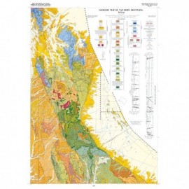
Crabapple Creek quadrangle, Texas Crabapple Creek quadrangle, Texas
$13.50Geologic Map of the Crabapple Creek Quadrangle, Gillespie and Llano Counties, Texas, by V. E. Barnes. Oversized color geologic map with text on the back, map scale 1:31,680, 1952. Paper map. Print Version.For a downloadable, digital version: GQ0003D. Geologic Map of the Crabapple Creek...
 In Stock
 -

Hilltop Quadrangle, Gillespie, Llano, and... Hilltop Quadrangle, Gillespie, Llano, and...
$11.50Geologic Map of the Hilltop Quadrangle, Gillespie, Llano, and Mason Counties, Texas, by V. E. Barnes. Oversized color map with text on the back, map scale 1:31,680, 1952. Digital Version.For a print version: GQ0002. Geologic Map of the Hilltop...
In Stock -

Hilltop quadrangle, Texas Hilltop quadrangle, Texas
$11.50Geologic Map of the Hilltop Quadrangle, Gillespie, Llano, and Mason Counties, Texas, by V. E. Barnes. Oversized color map with text on the back, map scale 1:31,680, 1952. Paper map. Print Version.For a downloadable, digital version: GQ0002D. Geologic Map of the Hilltop...
Out of stock -

Squaw Creek Quadrangle, Texas Squaw Creek Quadrangle, Texas
$11.50Geologic Map of the Squaw Creek Quadrangle, Gillespie and Mason Counties, Texas, by V. E. Barnes. Oversize color geologic map with text on back, map scale 1:31,680, 1952. Paper map. Print Version.A free, digital version of this publication can be found on: Texas ScholarWorks Geologic Map of the Squaw Creek...
In Stock