Maps at quadrangle scales depicting the surface geology of selected counties and areas in Texas, conducted between the 1950's-1988
Geologic Quadrangle Maps
-

Eagle Mountains...Hudspeth County, Texas Eagle Mountains...Hudspeth County, Texas
$19.00Geology of the Eagle Mountains and Vicinity, Hudspeth County, Texas, by J. R. Underwood, Jr. Scale 1:48,000; 32-p. text, 1963. Print Version.A free, digital version of this publication can be found on: Texas ScholarWorks Geology of the Eagle Mountains and...
 Out of stock
 -

Johnson City quadrangle, Blanco County,... Johnson City quadrangle, Blanco County,...
$13.50Geology of the Johnson City Quadrangle, Blanco County, Texas, by V. E. Barnes. Scale 1:24,000; 11-p. text, 1963. Digital Version.For a print version: GQ0025. Geology of the Johnson City...
In Stock -

Johnson City quadrangle, Blanco County, Texas Johnson City quadrangle, Blanco County, Texas
$13.50Geology of the Johnson City Quadrangle, Blanco County, Texas, by V. E. Barnes. Scale 1:24,000; 11-p. text, 1963. Print Version.For a downloadable, digital version: GQ0025D. Geology of the Johnson City...
In Stock -

Eastern...Kent Quadrangle, Culberson,... Eastern...Kent Quadrangle, Culberson,...
$14.50Geology of Eastern Half of Kent Quadrangle, Culberson, Reeves, and Jeff Davis Counties, Texas, by J. P. Brand and R. K. DeFord, 1962. 1 map with text. Print Version.A free, digital version of this publication can be found on: Texas ScholarWorks Geology of Eastern Half of Kent...
In Stock -

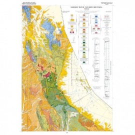
Van Horn Mountains, Texas Van Horn Mountains, Texas
$14.50Geology of Van Horn Mountains, Texas, by P. C. Twiss. Scale 1:48,000. 1959. Print Version.A free, digital version of this publication can be found on: Texas ScholarWorks Geology of Van Horn Mountains, Texas,...
In Stock -

Pinto Canyon Area, Presidio County, Texas.... Pinto Canyon Area, Presidio County, Texas....
$8.25Geology of the Pinto Canyon Area, Presidio County, Texas, by D. L. Amsbury. Oversize color map with text, scale 1:63,360. 1958 [1959]. Digital Version.For a print version: GQ0022. Geology of the Pinto Canyon Area,...
In Stock -

Pinto Canyon Area, Presidio County, Texas Pinto Canyon Area, Presidio County, Texas
$16.50Geology of the Pinto Canyon Area, Presidio County, Texas, by D. L. Amsbury. Oversize color map with text, scale 1:63,360. 1958 [1959]. Print Version.For a downloadable, digital version: GQ0022D. Geology of the Pinto Canyon Area,...
In Stock -

Wylie Mountains..., Culberson and Jeff... Wylie Mountains..., Culberson and Jeff...
$16.50Geology of Wylie Mountains... Culberson and Jeff Davis Counties, Texas - Dowloadable Digital Version.For a print version: GQ0021. Geology of Wylie Mountains......
In Stock -

Wylie Mountains...Culberson and Jeff Davis... Wylie Mountains...Culberson and Jeff Davis...
$16.50Geology of Wylie Mountains and Vicinity, Culberson and Jeff Davis Counties, Texas, by H. Hay-Roe. Oversize color map with text, scale 1:63,360. 1957. Print Version.For a downloadable, digital version: GQ0021D. Geology of Wylie Mountains and...
In Stock -

Threadgill Creek quadrangle, Texas Digital... Threadgill Creek quadrangle, Texas Digital...
$11.50Geologic Map of the Threadgill Creek Quadrangle, Gillespie and Mason Counties, Texas, by V. E. Barnes. Oversized color geologic map with text on the back, map scale 1:31,680, 1956. Digital Version.For a print version: GQ0020. Geologic Map of the Threadgill Creek...
In Stock -

Threadgill Creek quadrangle, Texas Threadgill Creek quadrangle, Texas
$11.50Geologic Map of the Threadgill Creek Quadrangle, Gillespie and Mason Counties, Texas, by V. E. Barnes. Oversized color geologic map with text, map scale 1:31,680, 1956. Oversized color geologic map with text on the back, map scale 1:31,680, 1956. Print Version.For a downloadable, digital version: GQ0020D. Geologic Map of the Threadgill Creek...
In Stock -

Fall Prong quadrangle, Texas Fall Prong quadrangle, Texas
$11.50Geologic Map of the Fall Prong Quadrangle, Kimble, Gillespie, and Mason Counties, Texas, by V. E. Barnes. Oversized color geologic map with text on the back, map scale 1:31,680, 1956. Paper map. Print Version.A free, digital version of this publication can be found on: Texas ScholarWorks Geologic Map of the Fall Prong...
In Stock