Bureau of Economic Geology Publications
| Title | Publication Year Sort ascending | Abstract | Author | Publisher | |
|---|---|---|---|---|---|
|
Geological characterization of Permian submarine fan reservoirs of the Driver Waterflood Unit, Spraberry trend, Midland basin, Texas | 1988 | More than 350 well logs and core and production data were used to geologically characterize oil reservoirs of the Driver waterflood unit of the Spraberry Trend in the Midland Basin, West Texas, and to assess the relationship between reservoir stratigraphy and oil recovery. |
Guevara, E.H. | Bureau of Economic Geology |
|
Hydrogeology and hydrochemistry of Cretaceous aquifers, Texas panhandle and eastern New Mexico | 1988 | Cretaceous rocks in the Southern High Plains, traditionally considered to be part of the High Plains aquifer and recharged by the overlying Ogallala aquifer, actually contain three aquifers with different recharge sources. |
Nativ, Ronit, Gutierrez, G.N. | Bureau of Economic Geology |

|
Centrifuge Modeling of the Effects of Aggradation and Progradation on Syndepositional Salt Structures | 1988 | The manner in which sedimentary overburden accumulates significantly influences the growth of syndepositional salt structures. |
Jackson, M.P.A., Talbot, C.J., Cornelius, R.R. | Bureau of Economic Geology |
|
Middle-Upper Miocene depositional sequences of the Texas coastal plain and continental shelf: geologic framework, sedimentary facies, and hydrocarbon plays | 1988 | Middle-upper Miocene depositional sequences of offshore Texas represent the last regionally significant influx of terrigenous elastic sediments into the western Gulf Coast Basin. |
Morton, R.A., Jirik, L.A., Galloway, W.E. | Bureau of Economic Geology |
|
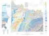
Geologic Atlas of Texas, Wichita Falls-Lawton sheet | 1987 | Geologic map that depicts the surface geology of Hardeman, Wilbarger, Wichita, Clay, Knox, Baylor, Archer, Haskell, Throckmorton, Young, and Foard Counties and part of Jack County, Texas. The 20-page booklet indicates geologic formations, abbreviations, and ages. |
Barnes, V.E., Hentz, T.F., Brown, L.F., Jr., Cleaves, A.W., Kier, R.S., McGowen, J.H., Parrish, W.C., Ramsey, J.W. | Bureau of Economic Geology |
|
Erosion rates and processes in subhumid and semiarid climates, Texas panhandle: statistical evaluation of field data | 1987 | Since 1978, six climate- and erosion-monitoring stations on slopes in draws and large playa lake basins in the interior of the Southern High Plains and slopes along the Caprock Escarpment in the Rolling Plains of the Texas Panhandle have recorded precipitation amount and intensity, air and soil t |
Simkins, W.W., Gustavson, T.C. | Bureau of Economic Geology |
|
Morphometric studies of subhumid and semiarid drainage basins, Texas panhandle and northeastern New Mexico | 1987 | Data from five drainage basins in the Texas Panhandle and northeastern New Mexico characterize the recent history of regional drainage basin formation and landscape development around the margins of the Southern High Plains. |
Baumgardner, R.W., Jr., Mawhorter, J.F., Moustafa, A.R., Myers, R.M., Sandstrom, M.A. | Bureau of Economic Geology |
|
Diagenesis and burial history of the Lower Cretaceous Travis Peak Formation, east Texas | 1987 | Sandstone in the Travis Peak (Hosston) Formation has been extensively modified by burial diagenesis. Permeability in much of the formation has been reduced to less than 0.1 md as a result of compaction, extensive precipitation of authigenic minerals, and minor pressure solution. |
Dutton, S.P. | Bureau of Economic Geology |
|
The Mineral Industry of Texas in 1985 | 1987 | Ohl, J.P., McBride, M.W. | Bureau of Economic Geology | |
|
Effects of hydrostratigraphy and basin development on hydrodynamics of the Palo Duro Basin, Texas | 1987 | Deep brine aquifers of the Palo Duro Basin, Texas Panhandle, ranging in depth from about 1,000 to 3,000 m below land surface, are underpressured compared with the shallow Ogallala aquifer. |
Senger, R.K., Fogg, G.E., Kreitler, C.W. | Bureau of Economic Geology |