Publications in Shelby
| Title | Publication Year Sort ascending | Abstract | Author | Series | Publisher | |
|---|---|---|---|---|---|---|
|
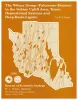
The Wilcox Group (Paleocene - Eocene) in the Sabine uplift area, Texas: depositional systems and deep-basin lignite | 1990 | Kaiser, W.R., Jackson, M.L.W., Sutley, A.M., Fly, D.J., Dobson, R.E. | Geological Folios | Bureau of Economic Geology | |
|
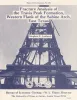
Fracture analysis of the Travis Peak Formation, western flank of the Sabine Arch, east Texas | 1989 | Successful development of low-permeability-sandstone gas reservoirs depends on an understandingof their natural fracture patterns and on predictions of the orientation of horizontal stresses.This report describes the preliminary results of fracture analysis of the Lower Cretaceous TravisPeak Form |
Laubach, S.E. | Report of Investigations | Bureau of Economic Geology |
|
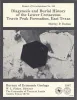
Diagenesis and burial history of the Lower Cretaceous Travis Peak Formation, east Texas | 1987 | Sandstone in the Travis Peak (Hosston) Formation has been extensively modified by burial diagenesis. Permeability in much of the formation has been reduced to less than 0.1 md as a result of compaction, extensive precipitation of authigenic minerals, and minor pressure solution. |
Dutton, S.P. | Report of Investigations | Bureau of Economic Geology |
|
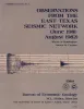
Observations from the east Texas seismic network (June 1981 - August 1982) | 1984 | Several microearthquake recording stations were operated as a network in the East Texas Basin beginning in June 1981. At least six certain and two probable earthquakes as well as hundreds of events of undetermined origin were recorded through August 1982. |
Pennington, W.D., Carlson, S.M. | Geological Circular | Bureau of Economic Geology |
|
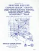
Regional aquifer characterization for deep-basin lignite mining, Sabine uplift area, northeast Texas | 1983 | Lignite deeper than 200 ft (61 m) constitutes about 60 percent of the total lignite resources in Texas. Projections indicate that meeting future demand will require mining this deep-basin lignite. |
Fogg, G.E., Kaiser, W.R., Ambrose, M.L., Macpherson, G.L. | Geological Circular | Bureau of Economic Geology |

|
Depositional systems in the Nacatoch Formation (Upper Cretaceous), northeast Texas and southwest Arkansas | 1983 | The Nacatoch Formation of the East Texas Basin is the middle formation of the Navarro Group and consists of marine sandstones and mudstones derived largely from source areas to the northwest, north, and northeast of the East Texas Embayment. |
McGowan, M.K., Lopez, C.M. | Report of Investigations | Bureau of Economic Geology |
|
Ground-water hydraulics and hydrochemical facies in Eocene aquifers of the east Texas basin | 1982 | Eocene stratigraphic units in the East Texas Basin are composed of a thick sedimentary sequence (approximately 2,000 ft [600 m]) of fresh-water aquifers and aquitards covering an area of approximately 15,000 mi2 (51,000 km2). |
Fogg, G.E., Kreitler, C.W. | Report of Investigations | Bureau of Economic Geology |

|
Structural cross sections, Tertiary formations, Texas Gulf Coast | 1981 | The publication comprises 24 structural dip cross sections, spaced 15 to 20 mi apart along the Texas coast, and 4 structural strike cross sections. Dip sections extend from near the Wilcox outcrop to the coastline. |
Dodge, M.M., Posey, J.S. | Cross Sections | Bureau of Economic Geology |
|
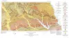
Geologic Atlas of Texas, Palestine sheet (revised 1993) | 1967 | Geologic map that depicts the surface geology of Nacogdoches, Shelby, San Augustine, Sabine, and Angelina Counties and parts of Anderson, Cherokee, Rusk, Newton, Jasper, Tyler, Polk, Trinity, Robertson, Madison, Leon, Freestone, and Panola Counties, Texas. |
Barnes, V.E., Humble Oil and Refining Co., Shell Oil Co., Pan American Petroleum Corp., Mobil Oil Co., Wright, A.C., McCallum, H.D., Wendlandt, E.A. | Geologic Atlas of Texas | Bureau of Economic Geology |
|
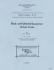
Rock and mineral resources of east Texas | 1965 | In the past 100 years, more than 100 names have been used to designate parts or all of the outcropping Midway and Wilcox rocks in the Gulf Coastal Plain; less than half of these names are used currently by Coastal Plain geologists, and the validity of some of the remaining named rock units has be |
Fisher, W.L., Chelf, C.R., Shelby, C.A., Garner, L.E., Owen, D.E., Shofield, D.A. | Report of Investigations | Bureau of Economic Geology |