Publications in Reeves
| Title | Publication Year Sort ascending | Abstract | Author | Series | Publisher | |
|---|---|---|---|---|---|---|
|
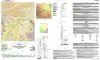
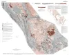
Geologic Map of the Toyahvale Quadrangle, Jeff Davis and Reeves Counties, Texas | 2025 | Hunt, B.B., Helper, M.A., Horne, E.A., Hennings, P.H., Rhoden, E. | Open-File Map | Bureau of Economic Geology | |
|
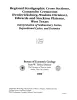
Regional stratigraphic cross sections, Comanche Cretaceous (Fredericksburg - Washita Division), Edwards and Stockton plateaus, West Texas: interpretation of sedimentary facies, depositional cycles, and tectonics | 2000 | Six interlocking regional stratigraphic cross sections of Lower Cretaceous strata (middle Albian-lower Cenomanian) of the Edwards and Stockton Plateaus of West Texas illustrate the vertical and lateral extent of lithostratigraphic units and distribution of facies and facies tracts. |
Smith, C.I., Brown, J.B., Lozo, F.E. | Cross Sections | Bureau of Economic Geology |
|
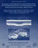
Geologic and engineering characterization of turbidite reservoirs, Ford Geraldine Unit, Bell Canyon Formation, West Texas | 1999 | This report summarizes results of an integrated geological, geophysical, petrophysical, and engineering study of a representative Delaware Mountain Group field to identify constraints on producibility in the deep-water sandstone reservoir exhibiting low primary recovery efficiency. |
Dutton, S.P., Barton, M.D., Asquith, G.B., Malik, M.A., Cole, A.G., Gogas, John, Guzman, J.I., Clift, S.J. | Report of Investigations | Bureau of Economic Geology |
|
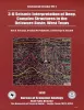
3-D seismic interpretation of deep, complex structures in the Delaware Basin, West Texas | 1999 | A multidisciplinary reservoir-characterization study of the Ellenburger Group was conducted over a 176-mi2 3-D seismic grid in Pecos, Reeves, and Ward Counties in the southern Delaware Basin of West Texas. |
Hardage, B.A., Pendleton, V.M., Asquith, G.B. | Geological Circular | Bureau of Economic Geology |

|
Electrical Imaging Catalog: Microresistivity Images and Core Photos from Fractured, Karsted, and Brecciated Carbonates | 1997 | Electrical images in boreholes are becoming increasingly important in interpreting the rock record. |
Hammes, Ursula | Geological Circular | Bureau of Economic Geology |
|
Depositional and diagenetic facies patterns and reservoir development in Silurian and Devonian rocks of the Permian basin | 1994 | Silurian and Devonian carbonate and chert rocks in the Permian Basin constitute a prolific hydrocarbon-bearing succession in West Texas and New Mexico. |
Ruppel, S.C., Holtz, M.H. | Report of Investigations | Bureau of Economic Geology |
|
Stratigraphic analysis of the Upper Devonian Woodford Formation, Permian Basin, West Texas and southeastern New Mexico | 1991 | The Upper Devonian Woodford Formation is an organic-rich petroleum source rock that extends throughout West Texas and southeastern New Mexico and currently is generating oil or gas in the subsurface. |
Comer, J.B. | Report of Investigations | Bureau of Economic Geology |
|
Geologic occurrence and regional assessment of evaporite-hosted native sulfur, Trans-Pecos Texas | 1989 | In the western Delaware Basin and southern Central Basin Platform of Trans-Pecos Texas, Upper Permian (Ochoan) evaporite strata host locally voluminous but notoriously unpredictable, sporadic deposits of biogenic native sulfur. |
Hentz, T.F., Price, J.G., Gutierrez, G.N. | Report of Investigations | Bureau of Economic Geology |
|
Compilation of potassium-argon ages of Tertiary igneous rocks, Trans-Pecos Texas | 1986 | This compilation of potassium-argon (K-Ar) ages of igneous rocks of the Tertiary volcanic field of Trans-Pecos Texas includes all published ages known to us as well as many unpublished results. |
Henry, C.D., McDowell, F.W., Price, J.G., Smyth, R.C. | Geological Circular | Bureau of Economic Geology |
|
Tectonic map of the Basin and Range Province of Texas and adjacent Mexico | 1985 | Henry, C.D., Price, J.G., Gluck, J.K., Bockoven, N.T. | Miscellaneous Map | Bureau of Economic Geology |