Publications in Randall
| Title | Publication Year Sort ascending | Abstract | Author | Series | Publisher | |
|---|---|---|---|---|---|---|
|
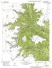
Geologic map of the Fortress Cliff Quadrangle, Texas | 1998 | Raney, J.A., Collins, E.W. | Open-File Map | Bureau of Economic Geology | |
|
Playas and recharge of the Ogallala aquifer on the southern High Plains of Texas -- an examination using numerical techniques | 1997 | This study used a numerical model to examine the playa-focused recharge theory by comparing it with the spatially uniform approach and with a zonal approach. |
Mullican, W.F., Johns, N.D., Fryar, A.E. | Report of Investigations | Bureau of Economic Geology |
|
Spatial variability in unsaturated flow beneath playa and adjacent interplaya settings and implications for contaminant transport, southern High Plains, Texas | 1997 | Analysis of spatial variability in unsaturated flow is critical to evaluating contaminant transport in areas of focused or preferential flow. This study examined spatial variability at a variety of scales from focused flow through playas to preferential flow in macropores. |
Scanlon, B.R., Goldsmith, R.S., Mullican, W.F. | Report of Investigations | Bureau of Economic Geology |
|
Water-level controls on halite sedimentation: Permian cyclic evaporites of the Palo Duro basin | 1994 | Extensively cored cyclic evaporites of the San Andres Formation (Guadalupian) of the Palo Duro Basin, Texas Panhandle, provided fundamental information for interpreting evaporite depositional processes. |
Hovorka, S.D. | Report of Investigations | Bureau of Economic Geology |
|
Geologic Significance of Remotely Sensed Physiographic Features of the Texas Panhandle and Adjacent Regions | 1990 | Remotely sensed features such as linear drainages, escarpments, ridges, and aligned playas have been identified on Landsat imagery (scale 1:250,000) of the Texas Panhandle and adjacent regions to allow comparison of these features with detailed regional and site-specific geologic data. |
Collins, E.W. | Geological Circular | Bureau of Economic Geology |
|
Tertiary and Quaternary stratigraphy and vertebrate paleontology of parts of northwestern Texas and eastern New Mexico | 1990 | This field guide summarizes recent interpretations of the upper Cenozoic stratigraphy of parts of the Southern High Plains and Rolling Plains in northwestern Texas and eastern New Mexico. |
Gustavson, T.C., Holliday, V.T., Osterkamp, W.R., Schultz, G.E., Winkler, D.A. | Guidebook | Bureau of Economic Geology |
|
Lithogenetic stratigraphy of the Triassic Dockum Formation, Palo Duro basin, Texas | 1989 | Four clastic depositional sequences compose the lower part of the Triassic Dockum Formation in the Palo Duro Basin. |
Johns, D.A. | Report of Investigations | Bureau of Economic Geology |
|
Tectonic structures of the Palo Duro basin, Texas panhandle | 1989 | The Palo Duro Basin is a broad structural low in the southern Texas Panhandle that formed as a result of nearly continuous Pennsylvanian and Permian subsidence. True complexity of this basin is unknown because of the sparsity of structural information. |
Budnik, R.T. | Report of Investigations | Bureau of Economic Geology |
|
Geomorphic processes and rates of retreat affecting the Caprock Escarpment, Texas panhandle | 1988 | The interaction of geomorphic and ground-water processes has produced the Caprock Escarpmentthat bounds the eastern margin of the Southern High Plains in the Texas Panhandle. |
Gustavson, T.C., Simpkins, W.W. | Report of Investigations | Bureau of Economic Geology |
|
Stratigraphy and influence of effective porosity on ground-water flow in the Wolfcamp brine aquifer, Palo Duro basin, Texas panhandle | 1988 | In the Palo Duro Basin, the Wolfcampian Series (lower Permian) overlies Pennsylvanian (primarily Virgilian) strata and underlies the Wichita Group (Leonardian). |
Conti, R.D., Herron, M.J., Senger, R.K., Wirojanagud, Prakob | Report of Investigations | Bureau of Economic Geology |