Publications in Karnes
| Title | Publication Year Sort ascending | Abstract | Author | Series | Publisher | |
|---|---|---|---|---|---|---|
|
Smackover and lower Buckner Formations, south Texas: depositional systems on a Jurassic carbonate ramp | 1981 | The Smackover and lower part of the Buckner Formations (Oxfordian) comprise a thick regressive sedimentary sequence deposited on a Jurassic carbonate ramp. Four major depositional systems are recognized: (1) basinal, (2) low-energy open shelf, (3) high-energy shoal, and (4) sabkha. |
Budd, D.A., Loucks, R.G. | Report of Investigations | Bureau of Economic Geology |

|
Structural cross sections, Tertiary formations, Texas Gulf Coast | 1981 | The publication comprises 24 structural dip cross sections, spaced 15 to 20 mi apart along the Texas coast, and 4 structural strike cross sections. Dip sections extend from near the Wilcox outcrop to the coastline. |
Dodge, M.M., Posey, J.S. | Cross Sections | Bureau of Economic Geology |
|
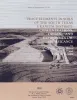
Trace elements in soils of the south Texas uranium district: concentrations, origin, and environmental significance | 1980 | The environmentally sensitive trace elements molybdenum, arsenic, and selenium are concentrated with uranium in ore deposits in South Texas. Cattle grazing in some pastures in mining areas have contracted molybdenosis, a cattle disease resulting from an imbalance of molybdenum and copper. |
Henry, C.D., Kapadia, R.R. | Report of Investigations | Bureau of Economic Geology |
|
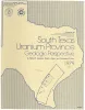
South Texas uranium province -- geologic perspective | 1979 | Galloway, W.E., Finley, R.J., Henry, C.D. | Guidebook | Bureau of Economic Geology | |
|
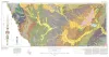
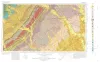
Geologic Atlas of Texas, Crystal City-Eagle Pass sheet | 1976 | Oversize color geologic map that depicts surface geology of Dimmit, LaSalle, and McMullen Counties and parts of Maverick, Zavala, Frio, Atascosa, Karnes, Wilson, Live Oak, Jim Wells, Duval, and Webb Counties, Texas. The 6-page booklet indicates geologic formations, abbreviations, and ages. |
Barnes, V.E., Humble Oil and Refining Co., Shell Oil Co., Amerada Petroleum Corp., Mobil Oil Co., Owens, Frith, Howeth, Ike, Brown, T.E. | Geologic Atlas of Texas | Bureau of Economic Geology |

|
South Texas uranium province: geology and extraction | 1976 | The increasing demand for uranium combined with the improving economics of uranium production have resulted in a significant upsurge in exploration and mining efforts in the South Texas Coastal Plain uranium province. Texas ranks third in U.S. uranium production. |
Galloway, W.E., Groat, C.G. | Research Note | |

|
Geologic Atlas of Texas, Beeville-Bay City sheet (revised 1987) | 1975 | Geologic map that depicts the surface geology of Goliad, Refugio, and Calhoun Counties and parts of Karnes, De Witt, Victoria, Jackson, Matagorda, Aransas, San Patricio, Bee, and Live Oak Counties. The 4-page booklet indicates geologic formations, abbreviations, and ages. |
Barnes, V.E., Brown, T.E., Brewton, J.L., Aronow, Saul, Eargle, D.H., Morton, R.G., Maxson, M.J., Wyeth, J.C. | Geologic Atlas of Texas | Bureau of Economic Geology |
|
Geologic Atlas of Texas, Seguin sheet | 1974 | Geologic map that depicts the surface geology of Colorado, Lavaca, and Gonzales Counties, and parts of Hays, Caldwell, Bastrop, Fayette, Austin, Waller, Fort Bend, Wharton, Matagorda, Jackson, Victoria, De Witt, Karnes, Wilson, and Guadalupe Counties, Texas. |
Barnes, V.E., Humble Oil and Refining Co., Shell Oil Co., Mobil Oil Co., Proctor, C.V., Jr., Brown, T.E., Waechter, N.B., Aronow, Saul | Geologic Atlas of Texas | Bureau of Economic Geology |
|
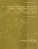
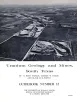
Uranium geology and mines, south Texas | 1971 | In recent years, exploration and mining of uranium have become a significant part of the Texas mineral scene, with Texas emerging as a leading uranium-producing state. At the end of 1970, Texas ranked third in reserves among the states, with ore reserves of 6.6 million tons. |
Eargle, D.H., Hinds, G.W., Weeks, A.M.D. | Guidebook | Bureau of Economic Geology |

|
Lithology and petrology of the Gueydan (Catahoula) Formation in south Texas | 1968 | Tuff, tuffaceous sand and clay, bentonite, and sandstone containing abundant volcanic rock detritus are present in Gulf Coast Tertiary rocks ranging in age from Eocene to Pliocene. |
McBride, E.F., Lindemann, W.L., Freeman, P.S. | Report of Investigations | Bureau of Economic Geology |