Publications in Houston
| Title | Publication Year Sort ascending | Abstract | Author | Series | Publisher | |
|---|---|---|---|---|---|---|
|
The Wilcox Group and Carrizo Sand (Paleogene) in east-central Texas: depositional systems and deep-basin lignite | 1985 | Ayers Jr., W.B., Lewis, A.H., Bissett, F.H., Mazza, D.B., Prouty, D.A., Reutter, D.C., Sutley, A.M. | Geological Folios | Bureau of Economic Geology | |
|
Sedimentary record of Cretaceous and Tertiary salt movement, east Texas basin: times, rates, and volumes of salt flow and their implications for nuclear waste isolation and petroleum exploration | 1984 | Post-Aptian strata (younger than 112 ma) in the East Texas Basin were strongly influenced by halokinesis and recorded the evolution associated sate structures. |
Seni, S.J., Jackson, M.P.A. | Report of Investigations | Bureau of Economic Geology |

|
Depositional systems in the Nacatoch Formation (Upper Cretaceous), northeast Texas and southwest Arkansas | 1983 | The Nacatoch Formation of the East Texas Basin is the middle formation of the Navarro Group and consists of marine sandstones and mudstones derived largely from source areas to the northwest, north, and northeast of the East Texas Embayment. |
McGowan, M.K., Lopez, C.M. | Report of Investigations | Bureau of Economic Geology |
|
Environmental geology of the Yegua - Jackson lignite belt, southeast Texas | 1982 | Environmental geologic maps of the Texas lignite belt were prepared in response to renewed production of lignite in Texas and enactment of Federal and State laws governing coal and lignite surface mining. |
Jackson, M.L.W., Garner, L.E., Sharpe, R.D. | Report of Investigations | Bureau of Economic Geology |
|
Regional structural cross sections and general stratigraphy, east Texas basin | 1981 | Jurassic, Cretaceous, and Tertiary sediments in the East Texas Basin have been structurally modified by movement of Middle Jurassic Louann Salt. |
Wood, D.H., Guevara, E.H. | Cross Sections | Bureau of Economic Geology |
|
Geology and geohydrology of the east Texas basin -- a report on the progress of nuclear waste isolation feasibility studies (1980) | 1981 | The third year of research was highlighted by the integration of regional basinal studies with growth histories for specific domes, studies of cap-rock diagenesis and salt deformation, preliminary studies of ground-water flow and geochemistry around Oakwood Dome, and preliminary studies of micros |
Kreitler, C.W., Collins, E.W., Davidson, E.D., Dix, O.R., Donaldson, G.A., Dutton, S.P., Fogg, G.E., Giles, A.B. | Geological Circular | Bureau of Economic Geology |
|
Quaternary faulting in East Texas | 1980 | Three closely spaced oblique-slip faults displace a Quaternary gravel and sand unit overlying Eocene Claiborne strata in the Trinity River Valley, Leon County. |
Collins, E.W., Hobday, D.K., Kreitler, C.W. | Geological Circular | Bureau of Economic Geology |
|
Geology and geohydrology of the east Texas basin -- a report on the progress of nuclear waste isolation feasibility studies (1979) | 1980 | Analysis during the second year was highlighted by a historical characterization of East Texas Basin infilling, the development of a model to explain the growth history of the domes, the continued studies of the Quaternary in East Texas, and a better understanding of the near-dome and regional hy |
Kreitler, C.W., Agagu, O.K., Basciano, J.M., Collins, E.W., Dix, O.R., Dutton, S.P., Fogg, G.E., Giles, A.B. | Geological Circular | Bureau of Economic Geology |
|
Proceedings, Gulf Coast Lignite Conference: Geology, Utilization, and Environmental Aspects | 1978 | Papers in this volume were presented at the Gulf Coast Lignite Conference held in Austin, Texas, June 1976. |
Kaiser, W.R., McNulty, J.E. | Report of Investigations | Bureau of Economic Geology |
|
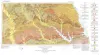
Geologic Atlas of Texas, Palestine sheet (revised 1993) | 1967 | Geologic map that depicts the surface geology of Nacogdoches, Shelby, San Augustine, Sabine, and Angelina Counties and parts of Anderson, Cherokee, Rusk, Newton, Jasper, Tyler, Polk, Trinity, Robertson, Madison, Leon, Freestone, and Panola Counties, Texas. |
Barnes, V.E., Humble Oil and Refining Co., Shell Oil Co., Pan American Petroleum Corp., Mobil Oil Co., Wright, A.C., McCallum, H.D., Wendlandt, E.A. | Geologic Atlas of Texas | Bureau of Economic Geology |