Publications in DeWitt
| Title | Publication Year Sort ascending | Abstract | Author | Series | Publisher | |
|---|---|---|---|---|---|---|
|
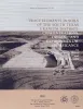
Trace elements in soils of the south Texas uranium district: concentrations, origin, and environmental significance | 1980 | The environmentally sensitive trace elements molybdenum, arsenic, and selenium are concentrated with uranium in ore deposits in South Texas. Cattle grazing in some pastures in mining areas have contracted molybdenosis, a cattle disease resulting from an imbalance of molybdenum and copper. |
Henry, C.D., Kapadia, R.R. | Report of Investigations | Bureau of Economic Geology |
|
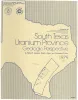
South Texas uranium province -- geologic perspective | 1979 | Galloway, W.E., Finley, R.J., Henry, C.D. | Guidebook | Bureau of Economic Geology | |
|
Catahoula Formation of the Texas coastal plain: depositional systems, composition, structural development, ground-water flow history, and uranium distribution | 1977 | The Catahoula Formation of the Texas Gulf Coastal Plain consists of two depositional systems--the Gueydan bedload fluvial system of the Rio Grande embayment and the Chita-Corrigan mixed load fluvial system of the Houston embayment. |
Galloway, W.E., Murphy, T.D., Belcher, R.C., Johnson, B.D., Sutton, Stanley | Report of Investigations | Bureau of Economic Geology |

|
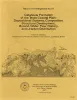
South Texas uranium province: geology and extraction | 1976 | The increasing demand for uranium combined with the improving economics of uranium production have resulted in a significant upsurge in exploration and mining efforts in the South Texas Coastal Plain uranium province. Texas ranks third in U.S. uranium production. |
Galloway, W.E., Groat, C.G. | Research Note | |

|
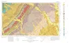
Geologic Atlas of Texas, Beeville-Bay City sheet (revised 1987) | 1975 | Geologic map that depicts the surface geology of Goliad, Refugio, and Calhoun Counties and parts of Karnes, De Witt, Victoria, Jackson, Matagorda, Aransas, San Patricio, Bee, and Live Oak Counties. The 4-page booklet indicates geologic formations, abbreviations, and ages. |
Barnes, V.E., Brown, T.E., Brewton, J.L., Aronow, Saul, Eargle, D.H., Morton, R.G., Maxson, M.J., Wyeth, J.C. | Geologic Atlas of Texas | Bureau of Economic Geology |

|
Geothermal resources, Frio Formation, middle Texas Gulf coast | 1975 | Knowledge of the regional sand distribution and its relationship to formation temperature and pressure is a preliminary step in evaluating the geothermal resources of the Frio Formation. |
Bebout, D.G., Agagu, O.K., Dorfman, M.H. | Geological Circular | Bureau of Economic Geology |
|
Geologic Atlas of Texas, Seguin sheet | 1974 | Geologic map that depicts the surface geology of Colorado, Lavaca, and Gonzales Counties, and parts of Hays, Caldwell, Bastrop, Fayette, Austin, Waller, Fort Bend, Wharton, Matagorda, Jackson, Victoria, De Witt, Karnes, Wilson, and Guadalupe Counties, Texas. |
Barnes, V.E., Humble Oil and Refining Co., Shell Oil Co., Mobil Oil Co., Proctor, C.V., Jr., Brown, T.E., Waechter, N.B., Aronow, Saul | Geologic Atlas of Texas | Bureau of Economic Geology |

|
Mineral resources of south Texas: region served through the port of Corpus Christi | 1962 | This report is a compilation of all available data on mineral resources (exclusive of oil and gas) in 39 south Texas counties. Information from published and unpublished sources was checked and supplemented by field investigations. |
Maxwell, R.A. | Report of Investigations | Bureau of Economic Geology |

|
The Gueydan, a new Middle Tertiary formation from the southwestern coastal plain of Texas | 1926 | Bailey, T.L. | UT Bulletin |