Publications in Burleson
| Title | Publication Year Sort ascending | Abstract | Author | Series | Publisher | |
|---|---|---|---|---|---|---|
|
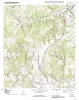
Geologic map of the Goodwill quadrangle, Texas | 2007 | Collins, E.W. | Open-File Map | Bureau of Economic Geology | |
|
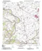
Geologic map of the Mumford quadrangle, Texas | 2007 | Collins, E.W. | Open-File Map | Bureau of Economic Geology | |
|
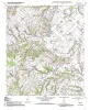
Geologic map of the Tunis quadrangle, Texas | 2007 | Collins, E.W. | Open-File Map | Bureau of Economic Geology | |
|
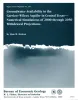
Groundwater availability in the Carrizo-Wilcox aquifer in central Texas -- numerical simulations of 2000 through 2050 withdrawal projections | 1999 | Between 1951 and 1996, groundwater pumpage from the Carrizo-Wilcox aquifer, one of Texas' major aquifer systems, increased in the area between the Colorado and Brazos Rivers from approximately 10,600 to 37,900 acre-ft/yr, primarily as a result of mining needs. |
Dutton, A.R. | Report of Investigations | Bureau of Economic Geology |
|
The Wilcox Group and Carrizo Sand (Paleogene) in east-central Texas: depositional systems and deep-basin lignite | 1985 | Ayers Jr., W.B., Lewis, A.H., Bissett, F.H., Mazza, D.B., Prouty, D.A., Reutter, D.C., Sutley, A.M. | Geological Folios | Bureau of Economic Geology | |
|
Environmental geology of the Yegua - Jackson lignite belt, southeast Texas | 1982 | Environmental geologic maps of the Texas lignite belt were prepared in response to renewed production of lignite in Texas and enactment of Federal and State laws governing coal and lignite surface mining. |
Jackson, M.L.W., Garner, L.E., Sharpe, R.D. | Report of Investigations | Bureau of Economic Geology |

|
Structural cross sections, Tertiary formations, Texas Gulf Coast | 1981 | The publication comprises 24 structural dip cross sections, spaced 15 to 20 mi apart along the Texas coast, and 4 structural strike cross sections. Dip sections extend from near the Wilcox outcrop to the coastline. |
Dodge, M.M., Posey, J.S. | Cross Sections | Bureau of Economic Geology |

|
Environmental geology of the Wilcox Group lignite belt, east Texas | 1979 | This report provides a data base for decisions about lignite mining and reclamation in the Wilcox Group of East Texas. Kaiser (1974, 1978) estimates that about 12.2 billion short tons of potentially strip-minable lignite resources occur in East and South Texas. |
Henry, C.E., Basciano, J.M. | Report of Investigations | Bureau of Economic Geology |
|
Proceedings, Gulf Coast Lignite Conference: Geology, Utilization, and Environmental Aspects | 1978 | Papers in this volume were presented at the Gulf Coast Lignite Conference held in Austin, Texas, June 1976. |
Kaiser, W.R., McNulty, J.E. | Report of Investigations | Bureau of Economic Geology |
|
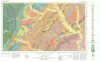
Geologic Atlas of Texas, Austin sheet | 1974 | Geologic map that depicts the surface geology of Burleson, Lee, Washington, and Brazos Counties and parts of Burnet, Bell, Milam, Robertson, Madison, Grimes, Waller, Austin, Fayette, Bastrop, Caldwell, Hays, Travis, and Williamson Counties. |
Barnes, V.E., Shell Oil Co., Humble Oil and Refining Co., Mobil Oil Co., Proctor, C.V., Jr., Brown, T.E., McGowen, J.H., Waechter, N.B. | Geologic Atlas of Texas | Bureau of Economic Geology |