Publications in Bee
| Title | Publication Year Sort ascending | Abstract | Author | Series | Publisher | |
|---|---|---|---|---|---|---|
|
Depositional and diagenetic history of the Sligo and Hosston Formations(Lower Cretaceous) in south Texas | 1981 | The Sligo and Hosston Formations of Aptian age occur over thousands of square miles in the subsurface of South Texas. |
Bebout, D.G., Budd, D.A., Schatzinger, R.A. | Report of Investigations | Bureau of Economic Geology |
|
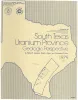
South Texas uranium province -- geologic perspective | 1979 | Galloway, W.E., Finley, R.J., Henry, C.D. | Guidebook | Bureau of Economic Geology | |

|
Depositional patterns of Miocene facies, middle Texas coastal plain | 1979 | Doyle, J.D. | Report of Investigations | Bureau of Economic Geology | |
|
Environmental geologic Atlas of the Texas coastal zone -- Corpus Christi area | 1976 | The Texas Coastal Zone is marked by diversity in geography, resources, climate, and industry. |
Brown, L.F., Jr., Brewton, J.L., McGowen, J.H., Evans, T.J., Fisher, W.L., Groat, C.G. | Environmental Geologic Atlas of the Texas Coastal Zone | Bureau of Economic Geology |
|
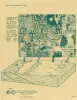
Geologic Atlas of Texas, Crystal City-Eagle Pass sheet | 1976 | Oversize color geologic map that depicts surface geology of Dimmit, LaSalle, and McMullen Counties and parts of Maverick, Zavala, Frio, Atascosa, Karnes, Wilson, Live Oak, Jim Wells, Duval, and Webb Counties, Texas. The 6-page booklet indicates geologic formations, abbreviations, and ages. |
Barnes, V.E., Humble Oil and Refining Co., Shell Oil Co., Amerada Petroleum Corp., Mobil Oil Co., Owens, Frith, Howeth, Ike, Brown, T.E. | Geologic Atlas of Texas | Bureau of Economic Geology |
|
South Texas uranium province: geology and extraction | 1976 | The increasing demand for uranium combined with the improving economics of uranium production have resulted in a significant upsurge in exploration and mining efforts in the South Texas Coastal Plain uranium province. Texas ranks third in U.S. uranium production. |
Galloway, W.E., Groat, C.G. | Research Note | |
|
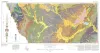
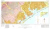
Geologic Atlas of Texas, Beeville-Bay City sheet (revised 1987) | 1975 | Geologic map that depicts the surface geology of Goliad, Refugio, and Calhoun Counties and parts of Karnes, De Witt, Victoria, Jackson, Matagorda, Aransas, San Patricio, Bee, and Live Oak Counties. The 4-page booklet indicates geologic formations, abbreviations, and ages. |
Barnes, V.E., Brown, T.E., Brewton, J.L., Aronow, Saul, Eargle, D.H., Morton, R.G., Maxson, M.J., Wyeth, J.C. | Geologic Atlas of Texas | Bureau of Economic Geology |
|
Geothermal resources, Frio Formation, middle Texas Gulf coast | 1975 | Knowledge of the regional sand distribution and its relationship to formation temperature and pressure is a preliminary step in evaluating the geothermal resources of the Frio Formation. |
Bebout, D.G., Agagu, O.K., Dorfman, M.H. | Geological Circular | Bureau of Economic Geology |

|
Natural hazards of the Texas coastal zone | 1974 | The Texas Coastal Zone is marked by diversity in geography, resources, climate, and industry. |
Brown, L.F., Jr., Morton, R.A., McGowen, J.H., Kreitler, C.W., Fisher, W.L. | Selected Reports | Bureau of Economic Geology |
|
Mineral resources of south Texas: region served through the port of Corpus Christi | 1962 | This report is a compilation of all available data on mineral resources (exclusive of oil and gas) in 39 south Texas counties. Information from published and unpublished sources was checked and supplemented by field investigations. |
Maxwell, R.A. | Report of Investigations | Bureau of Economic Geology |