Publications by Morton, R.A.
| Title | Publication Year Sort ascending | Abstract | Author | Series | Publisher | |
|---|---|---|---|---|---|---|
|
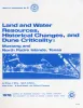
Land and water resources, historical changes, and dune criticality: Mustang and North Padre Islands, Texas | 1978 | Barrier islands along the Texas Coastal Zone are part of a complex and dynamic system represented by many distinct yet interrelated environments affected by a variety of resources, natural processes, climatic conditions, and human activities. |
White, W.A., Morton, R.A., Kerr, R.S., Kuenzi, W.D., Brogden, W.B. | Report of Investigations | Bureau of Economic Geology |
|
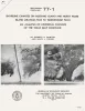
Shoreline changes on Mustang Island and North Padre Island (Aransas Pass to Yarborough Pass) -- an analysis of historical changes of the Texas Gulf shoreline | 1977 | Historical monitoring along Mustang and north Padre Islands records the nature and magnitude of changes in position of the shoreline and vegetation line and provides insight into the factors affecting those changes. |
Morton, R.A., Pieper, M.J. | Geological Circular | Bureau of Economic Geology |
|
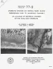
Shoreline changes on central Padre Island (Yarborough Pass to Mansfield Channel) -- an analysis of historical changes of the Texas Gulf shoreline | 1977 | Historical monitoring along central Padre Island records the nature and magnitude of changes in position of the shoreline and vegetation line and provides insight into the factors affecting those changes. |
Morton, R.A., Pieper, M.J. | Geological Circular | Bureau of Economic Geology |

|
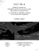
Historical Shoreline Changes and Their Causes, Texas Gulf Coast | 1977 | Sequential shoreline monitoring, using vintage chans and aerial photographs, documents temporal and spatial variations in historical Gulf shoreline changes. |
Morton, R.A. | Geological Circular | Bureau of Economic Geology |
|
Shoreline changes on Matagorda Island and San Jose Island (Pass Cavallo to Aransas Pass) -- an analysis of historical changes of the Texas Gulf shoreline | 1976 | Historical monitoring along Matagorda Island and San Jose Island records the nature and magnitude of changes in position of the shoreline and vegetation line and provides insight into the factors affecting those changes. |
Morton, R.A., Pieper, M.J. | Geological Circular | Bureau of Economic Geology |
|
Shoreline changes on Matagorda Peninsula (Brown Cedar Cut to Pass Cavallo) -- an analysis of historical changes of the Texas Gulf shoreline | 1976 | Historical monitoring along Matagorda Peninsula from Brown Cedar Cut to Pass Cavallo records the nature and magnitude of changes in position of the shoreline and vegetation line and provides insight into the factors affecting those changes. |
Morton, R.A., Pieper, M.J., McGowen, J.H. | Geological Circular | Bureau of Economic Geology |
|
Shoreline changes on Brazos Island and south Padre Island (Mansfield Channel to north of the Rio Grande) -- an analysis of historical changes of the Texas Gulf shoreline | 1975 | Historical monitoring along Brazos and south Padre Islands records the nature and magnitude of changes in position of the shoreline and vegetation line and provides insight into the factors affecting those changes. |
Morton, R.A., Pieper, M.J. | Geological Circular | Bureau of Economic Geology |
|
Shoreline changes in the vicinity of Brazos River delta (San Luis Pass to Brown Cedar Cut) -- an analysis of historical changes of the Texas Gulf shoreline | 1975 | Historical monitoring in the vicinity of the Brazos River delta (San Luis Pass to Brown Cedar Cut) records the nature and magnitude of changes in position of the shoreline 'and vegetation line and provides insight into the factors affecting those changes. |
Morton, R.A., Pieper, M.J. | Geological Circular | Bureau of Economic Geology |
|
Shoreline changes between Sabine Pass and Bolivar Roads -- an analysis of historical changes of the Texas Gulf shoreline | 1975 | Historical monitoring between Sabine Pass and Bolivar Roads records the nature and magnitude of changes in position of the shoreline and vegetation line and provides insight into the factors affecting those changes. |
Morton, R.A. | Geological Circular | Bureau of Economic Geology |
|
Shoreline changes on Galveston Island (Bolivar Roads to San Luis Pass) -- an analysis of historical changes of the Texas Gulf shoreline | 1974 | Historical monitoring along Galveston Island records the type and magnitude of changes in position of the shoreline and vegetation line and provides insight into the factors affecting those changes. |
Morton, R.A. | Geological Circular | Bureau of Economic Geology |