Publications by Morton, R.A.
| Title | Publication Year Sort ascending | Abstract | Author | Series | Publisher | |
|---|---|---|---|---|---|---|
|
Gulf shoreline movement between Sabine Pass and the Brazos River, Texas: 1974 to 1996 | 1997 | Changes in shoreline position along the southeastern Texas Gulf coast between 1974 and 1996 were documented by conducting a kinematic real-time differential global positioning system (DGPS) field survey in 1996 and comparing that shoreline with other shorelines archived in a geographic informatio |
Morton, R.A. | Geological Circular | Bureau of Economic Geology |
|
Historical shoreline changes in Copano, Aransas, and Redfish Bays, Texas Gulf coast | 1993 | Shorelines bordering the bays of Texas are generally not as dynamic as those along the Gulf of Mexico. Nevertheless, the predominantly erosional movement of these bay shorelines translates to large losses of wetlands, arable uplands, and recreational and residential property. |
Paine, J.G., Morton, R.A. | Geological Circular | Bureau of Economic Geology |
|
Plio-Pleistocene genetic sequences of the southwestern Louisiana continental shelf and slope: geologic framework, sedimentary facies, and hydrocarbon distribution | 1992 | The Plio-Pleistocene hydrocarbon fairway of offshore western Louisiana is restricted to the outer continental shelf and upper continental slope where a thick wedge of nearshore and deep-marine sediments was deposited. |
Morton, R.A., Ayers Jr., W.B. | Report of Investigations | Bureau of Economic Geology |
|
Plio-Pleistocene depositional sequences of the southeastern Texas continental shelf and slope: geologic framework, sedimentary facies, and hydrocarbon distribution | 1991 | Plio-Pleistocene strata of offshore Texas having hydrocarbon exploration potential are restricted to the southeastern continental shelf and upper continental slope. This thick wedge of nearshore and deep-marine sediments firms the west margin of a late Neogene and Quaternary depocenter. |
Morton, R.A., Sams, R.H., Jirik, L.A., Banta, N.J., Single, R.S. | Report of Investigations | Bureau of Economic Geology |
|
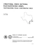
Structural cross sections, Plio-Pleistocene series, southeastern Texas | 1989 | These cross sections illustrate the regional structure and stratigraphy beneath the Texas continental shelf . |
Morton, R.A., Jirik, L.A. | Cross Sections | Bureau of Economic Geology |
|
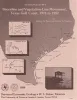
Shoreline and vegetation-line movement, Texas Gulf coast, 1974 to 1982 | 1989 | The purposes of this study were (1) to quantify recent (1974 to 1982) movement of Texas shorelines and vegetation lines by analysis of aerial photographs; (2) to place this movement in historical (pre-1974) context; and (3) to examine the influence of environmental variables such as storms, sea l |
Paine, J.G., Morton, R.A. | Geological Circular | Bureau of Economic Geology |
|
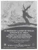
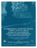
Submerged lands of Texas, Kingsville area: sediments, geochemistry, benthic macroinvertebrates, and associated wetlands | 1989 | The State-owned submerged lands of Texas encompass almost 6,000 mi2 (15,540 km2). They lie below waters of the bay-estuary-lagoon system and the Gulf of Mexico and extend 10.3 mi (16.6 km) seaward from the Gulf shoreline (fig. 1). |
White, W.A., Calnan, T.R., Morton, R.A., Kimble, R.S., Littleton, T.G., McGowen, J.H., Nance, H.S. | Submerged Lands of Texas | Bureau of Economic Geology |
|
Submerged lands of Texas, Port Lavaca area: sediments, geochemistry, benthic macroinvertebrates, and associated wetlands | 1989 | The State-owned submerged lands of Texas encompass almost 6,000 mi2 (15,540 km2). They lie below waters of the bay-estuary-lagoon system and the Gulf of Mexico and extend 10.3 mi (16.6 km) seaward from the Gulf shoreline (fig. 1). |
White, W.A., Calnan, T.R., Morton, R.A., Kimble, R.S., Littleton, T.G., McGowen, J.H., Nance, H.S. | Submerged Lands of Texas | Bureau of Economic Geology |

|
Submerged lands of Texas, Bay City - Freeport area: sediments, geochemistry, benthic macroinvertebrates, and associated wetlands | 1988 | The State-owned submerged lands of Texas encompass almost 6,000 mi2 (15,540 km2). They lie below waters of the bay-estuary-lagoon system and the Gulf of Mexico and extend 10.3 mi (16.6 km) seaward from the Gulf shoreline (fig. 1). |
White, W.A., Calnan, T.R., Morton, R.A., Kimble, R.S., Littleton, T.G., McGowen, J.H., Nance, H.S. | Submerged Lands of Texas | Bureau of Economic Geology |
|
Middle-Upper Miocene depositional sequences of the Texas coastal plain and continental shelf: geologic framework, sedimentary facies, and hydrocarbon plays | 1988 | Middle-upper Miocene depositional sequences of offshore Texas represent the last regionally significant influx of terrigenous elastic sediments into the western Gulf Coast Basin. |
Morton, R.A., Jirik, L.A., Galloway, W.E. | Report of Investigations | Bureau of Economic Geology |