
Publication Year
1997
Publisher
Series
Open-File Map
Publication Year
1997
Publisher
Series
Open-File Map
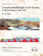
Publication Year
1997
Publisher
Series
Report of Investigations
Abstract
This report subjectively reviews the chief conceptual breakthroughs in understanding salt tectonics. Each discovery and its implications are presented as simply as possible. The history of salt tectonics divides naturally into three parts, defined here as the Pioneering Era, the Fluid Era, and the Brittle Era. The Pioneering Era (1856 to 1933) featured the search for a general hypothesis of salt diapirism, which was initially dominated by erroneous notions of igneous activity, residual islands, in situ crystallization, osmotic pressures, and expansive crystallization.
Publication Year
1997
Publisher
Series
Atlases of Major Oil and Gas Reservoirs
Publication Year
1997
Publisher
Series
Open-File Map