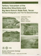
The Bofecillos Mountains and Big Bend Ranch State Park contain a complex sequence of volcanic, volcaniclastic, and intrusive rocks that erupted from sources both within and outside the area. Detailed geologic mapping and stratigraphic, petrographic, geochemical, and 40Ar/39Ar and K-Ar studies justify substantial revision of previously recognized relationships. Magmatism occurred in several distinct episodes between 47 and 18 Ma ago, spanning the complete range of activity in Trans-Pecos Texas.
A fundamental thesis of seismic stratigraphy is that seismic reflections follow impedance contrasts that coincide with stratal surfaces, which are surfaces where depositional processes occur at a fixed moment in geologic time. This stratal-surface concept is used herein to image a narrow (width--300 ft), thin, fluvial channel system that is embedded within a seismic reflection peak. The peak reflects from a large (about 2- x 2-mi) area where nonchannel facies dominate its waveshape. The targeted channel facies are confined to an interval that vertically spans less than 30 ft.