
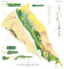
The Quitman Mountains are part of a narrow mountain range that extends southeastward from near Sierra Blanca, Texas (85 miles southeast of El Paso, Texas), into northern Mexico. The range is typical of many desert mountains of the southwestern United States in that it projects abruptly above the breached bolsons that border it. Thus, the Quitman Mountains stand in stark contrast topographically and geologically to the Hueco Bolson on the west and the Red Light Bolson on the east.
Trilobites collected during the past 20 years from the Morgan Creek, Point Peak, and San Saba Members of the Wilberns Formation comprise 89 species assigned to 45 genera belonging to zones of the upper Franconian and Trempealeauan Stages of the Upper Cambrian Croixan Series. New zonal names are proposed in the interest of a regionally applicable nomenclature. Although none of the zonal nomenclature is identical to that of the 1944 Cambrian Correlation Chart of Howell�et al.,�the four zones recognized in central Texas are equivalent to the eight highest zones on the Chart.
This work was begun in 1964 and substantially completed in 1965; at that time conodont zones had been established in North America only for the Upper Devonian, by Clark and Becker (1960) for the Great Basin and Collinson, Scott, and Rexroad (1962) for the mid-continent. Little was known of the conodonts of the New York section; there was almost no information on the Lower Devonian succession, and there was no published account of the Middle Devonian succession.
Tertiary rocks, including sandstone, conglomerate, shale, pyroclastics, tuff, and lava, are preserved in Big Bend National Park and in a much larger area to the west and northwest. Some of the rocks have distinctive characteristics that enable recognition by their lithology. Others are distinctly dissimilar, although they may have been deposited about the same time.
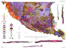
The Bofecillos Mountains area of Trans-Pecos Texas contains a Tertiary volcanic vent and a varied sequence of lava flows, tuff, ash-flow tuff, and associated conglomerate, sandstone, and mudrock; after most of the volcanic activity had ceased, the area was block faulled and later dissected into a rugged high-standing terrain with striking exposures.