
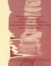
The Oakville Sandstone (Miocene) of the Texas Coastal Plain comprises a major sand-rich fluvial system composed of deposits of several major and minor rivers that originated within Texas and surrounding states. Broad bed-load fluvial axes, including the Hebbronville, George West, and New Davy trends, lie south of the San Marcos Arch and host significant reserves of uranium. To the north, the Moulton streamplain consists of deposits of numerous small, flashy to ephemeral streams that drained the inland margin of the Coastal Plain.
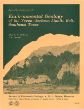
Environmental geologic maps of the Texas lignite belt were prepared in response to renewed production of lignite in Texas and enactment of Federal and State laws governing coal and lignite surface mining. The map area of this report encompasses the outcrop of the Yegua Formation and Jackson Group from south-central Texas to the Texas-Louisiana border. Yegua sediments are fluvial in outcrop, and deltaic in the deeper subsurface. Jackson deposits are predominantly of deltaic origin. Mapping involved interpretation of black-and-white, large-scale aerial photographs and extensive field work.
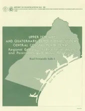
Upper Miocene, Pliocene, and Pleistocene deposits in the subsurface of the central Coastal Plain of Texas were subdivided into six operational units comprising the surface-defined Fleming, Goliad, Willis, Lissie, and Beaumont Formations. These sedimentary units constitute the last major depositional episodes in the northwestern Gulf Coast Basin. Late Miocene deposition is represented by transgressive shelf and shallow-marine shales overlain by progradational clastics of the upper part of the Lower Fleming, Upper Fleming, and Lower Goliad-Willis units.
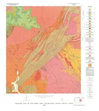
Analysis of seven frames of Landsat imagery covering the Texas Panhandle and adjacent areas revealed linear physiographic features including stream channels, stream valleys, scarps, and aligned playa-lake depressions. These lineaments show preferred orientations of 300°-320°, 030°-050°, and, 0°-020°. The 300°-320° orientation of aligned playas and shallow surface drainage is best developed on the surface of the Southern High Plains. The orthogonal 030°-050° orientation is less well represented.