
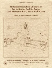
Changes in the position and stability of shorelines in the San Antonio Bay system (San Antonio, Espiritu Santo, and Mesquite Bays), Texas Gulf Coast, were documented using historical monitoring techniques.
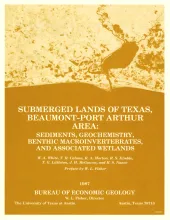
The State-owned submerged lands of Texas encompass almost 6,000 mi2 (15,540 km2). They lie below waters of the bay-estuary-lagoon system and the Gulf of Mexico and extend 10.3 mi (16.6 km) seaward from the Gulf shoreline (fig. 1). The importance of these lands and their resources to resident flora and fauna as well as to people is well known and documented; more than one-third of the state's population is concentrated within an area of the Coastal Zone that is only about one-sixteenth of the state's land area.
Porous and permeable strata of the Deep-Basin Brine aquifer underlie bedded evaporites that are being considered as repositories for high-level nuclear waste isolation in the Palo Duro Basin, Texas Panhandle. Formation-water samples collected from four U.S.
Ground water that moves downward from aquifers in clastic rocks of the Triassic Dockum Group and Neogene Ogallala Formation dissolves bedded halite and anhydrite in the Upper Permian evaporite section along the perimeter of the Southern High Plains in the Texas Panhandle. Ground-water velocity in salt-dissolution zones beneath the Canadian River valley and Rolling Plains may be greater than ground-water velocity in salt-dissolution zones beneath the Southern High Plains because of greater hydraulic conductivity and greater hydraulic-head gradient.
Topographically controlled ground-water-basin divides, established during the Pleistocene by erosion of the Pecos and Canadian River valleys, prevent ground-water recharge in the outcrop of the Triassic Dockum Group from entering the confined part of the aquifer in the Dockum Group beneath the Southern High Plains in the Texas Panhandle and eastern New Mexico. Ground water in the confined aquifer was probably recharged from precipitation at higher elevations in eastern New Mexico before thick deposits of Dockum Group sandstones were eroded.