Lower Cretaceous shallow-water carbonates accumulated on a broad shelf which completely encircled the Gulf of Mexico. Biogenic growth climaxed along the basinward edge, or shelf margin, where a complex of reefs, banks, bars, and islands developed. The sediments reached a total thickness of 2,000 to 2,500 feet; numerous deep wells ranging in total depth from 11,000 to 20,000 feet have resulted in the discovery of a few marginally productive gas fields.
The stratigraphic record yields evidence that each episode of clastic silicate deposition has been of limited duration and that each has been preceded and followed by a significant hiatus. Evidence for alternations of deposition and nondeposition is readily apparent in the landward portions of Pleistocene deposits along the Gulf Coast, due to the glacio-eustatic changes in sea level; evidence of alternations, although elusive, exists also in the basinward portions of these deposits.
Historical monitoring along Galveston Island records the type and magnitude of changes in position of the shoreline and vegetation line and provides insight into the factors affecting those changes. Documentation of changes is aided by the compilation of shoreline and vegetation line position from topographic maps, aerial photographs, and coastal charts of various vintages.
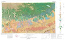
Geologic map that depicts the surface geology of Comal, Bandera, Bexar, and Medina Counties and parts of Real, Kerr, Kendall, Hays, Guadalupe, Wilson, Atascosa, Frio, Zavala, and Uvalde Counties, Texas. The 9-page booklet indicates geologic formations, abbreviations, and ages.
A preliminary study of the Frio sand distribution and formation temperatures and pressures was undertaken in order to define prospective areas in which a more detailed reservoir analysis is necessary prior to the selection of a site for a geothermal well.