Oversize, color geologic maps on a topographic base, scale 1:24,000, depicting various geologic quadrangles in Texas, with informal text booklet, 1990's to the present
STATEMAP Project Maps
-

McQueeney quadrangle, Texas McQueeney quadrangle, Texas
$15.00Geologic Map of the McQueeney Quadrangle, Texas, by E. W. Collins. Oversize geologic map on color topographic base, map scale 1:24,000, with explanatory text, 1993. Print Version.For a downloadable, digital version: OFM0102D. Geologic Map of the McQueeney...
 In Stock
 -

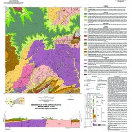
Marion quadrangle, Texas. Digital Download Marion quadrangle, Texas. Digital Download
$10.00Geologic Map of the Marion Quadrangle, Texas, by E. W. Collins. Oversize geologic map on color topographic base, map scale 1:24,000, with explanatory text, 1993. Digital Version.For a print version: OFM0101. Geologic Map of the Marion...
In Stock -

Marion quadrangle, Texas Marion quadrangle, Texas
$15.00Geologic Map of the Marion Quadrangle, Texas, by E. W. Collins. Oversize geologic map on color topographic base, map scale 1:24,000, with explanatory text, 1993. Print Version.For a downloadable, digital version: OFM0101D. Geologic Map of the Marion...
This map is currently printed on demand. Please allow a few extra days for processing. -

Jack Mountain quadrangle, Texas. Digital... Jack Mountain quadrangle, Texas. Digital...
$10.00Geologic Map of the Jack Mountain Quadrangle, Texas, by E. W. Collins. Oversize geologic map on color topographic base, map scale 1:24,000, with explanatory text, 1995. Digital Version.For a print version: OFM0100. Geologic Map of the Jack Mountain...
In Stock -

Jack Mountain quadrangle, Texas Jack Mountain quadrangle, Texas
$15.00Geologic Map of the Jack Mountain Quadrangle, Texas, by E. W. Collins. Oversize geologic map on color topographic base, map scale 1:24,000, with explanatory text, 1995. Print Version.For a downloadable, digital version: OFM0100D. Geologic Map of the Jack Mountain...
This map is currently printed on demand. Please allow a few extra days for processing. -

Hunter quadrangle, Texas. Digital Download Hunter quadrangle, Texas. Digital Download
$10.00Geologic Map of the Hunter Quadrangle, Texas, by E. W. Collins. Oversize geologic map on color topographic base, map scale 1:24,000, with explanatory text, 1991. Digital Version.For a print version: OFM0099. Geologic Map of the Hunter...
In Stock -

Hunter quadrangle, Texas Hunter quadrangle, Texas
$15.00Geologic Map of the Hunter Quadrangle, Texas, by E. W. Collins. Oversize geologic map on color topographic base, map scale 1:24,000, with explanatory text, 1991. Print Version.For a downloadable, digital version: OFM0099D. Geologic Map of the Hunter...
In Stock -

Comfort quadrangle, Texas. Digital Download Comfort quadrangle, Texas. Digital Download
$10.00Geologic Map of the Comfort Quadrangle, Texas, by E. W. Collins. Oversize geologic map on color topographic base, map scale 1:24,000, with explanatory text, 1995. Digital Version.For a print version: OFM0098. Geologic Map of the Comfort...
In Stock -

Comfort quadrangle, Texas Comfort quadrangle, Texas
$15.00Geologic Map of the Comfort Quadrangle, Texas, by E. W. Collins. Oversize geologic map on color topographic base, map scale 1:24,000, with explanatory text, 1995. Print Version.For a downloadable, digital version: OFM0098D. Geologic Map of the Comfort...
This map is currently printed on demand. Please allow a few extra days for processing. -

Bat Cave quadrangle, Texas. Digital Download Bat Cave quadrangle, Texas. Digital Download
$10.00Geologic Map of the Bat Cave Quadrangle, Texas, by E. W. Collins. Oversize geologic map on color topographic base, map scale 1:24,000, with explanatory text, 1998. Digital Version.For a print version: OFM0097. Geologic Map of the Bat Cave...
In Stock -

Bat Cave quadrangle, Texas Bat Cave quadrangle, Texas
$15.00Geologic Map of the Bat Cave Quadrangle, Texas, by E. W. Collins. Oversize geologic map on color topographic base, map scale 1:24,000, with explanatory text, 1998. Print Version.For a downloadable, digital version: OFM0097D. Geologic Map of the Bat Cave...
In Stock -

Weir Quadrangle, Texas. Digital Download Weir Quadrangle, Texas. Digital Download
$10.00Geologic Map of the Weir Quadrangle, Texas, by E. W. Collins. Oversize geologic map on color topographic base, map scale 1:24,000, with explanatory text, 1997. Digital Version.For a print version: OFM0096. Geologic Map of the Weir Quadrangle,...
In Stock