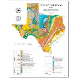
Page- and poster-size maps of Texas geology, tectonics, physiography, river basins, land resources, vegetation/cover types, aquifers, industrial minerals, soils, and ecoregions.
Thematic Maps
-

Vegetation/Cover Types of Texas Poster.... Vegetation/Cover Types of Texas Poster....
$0.00Vegetation/Cover Types of Texas, by R. G. Frye, K. L. Brown, and C. A. McMahan, Poster, 2000. Digital Version.For a print version: SM0008P. Vegetation/Cover Types of Texas, by...
 In Stock
 -
")
Vegetation/Cover Types of Texas Poster Vegetation/Cover Types of Texas Poster
$20.00Vegetation/Cover Types of Texas, by R. G. Frye, K. L. Brown, and C. A. McMahan, Poster, 2000. Print Version.For a downloadable, digital version: SM0008PD. Vegetation/Cover Types of Texas, by...
Out of stock -

Vegetation/Cover Types of Texas. Page... Vegetation/Cover Types of Texas. Page...
$0.00Vegetation/Cover Types of Texas, by R. G. Frye, K. L. Brown, and C. A. McMahan, page-sized, map scale: 1 inch = 100 miles, 2000. Digital Version.For a print version: SM0008. Vegetation/Cover Types of Texas, by...
In Stock -

Vegetation/Cover Types of Texas. Page Sized Vegetation/Cover Types of Texas. Page Sized
$0.25Vegetation/Cover Types of Texas, by R. G. Frye, K. L. Brown, and C. A. McMahan, page-sized, map scale: 1 inch = 100 miles, 2000. Print Version.For a downloadable, digital version: SM0008D. Vegetation/Cover Types of Texas, by...
In Stock -
 - Downloadable")
Land Resource Map of Texas Poster. Digital... Land Resource Map of Texas Poster. Digital...
$0.00Land Resources of Texas Map, Poster. Digital Version.For a print version: SM0007P. Land Resources of Texas Map, Poster....
In Stock -
")
Land Resource Map of Texas Poster Land Resource Map of Texas Poster
$20.00Land Resources of Texas Map, Poster. Print Version.For a downloadable, digital version: SM0007PD. Land Resources of Texas Map, Poster....
Out of stock -

Land Resource Map of Texas. Page Sized.... Land Resource Map of Texas. Page Sized....
$0.00Land Resources of Texas, page-sized, map scale: 1 inch = 100 miles, 1999. Digital Version.For a print version: SM0007. Land Resources of Texas, page-sized,...
In Stock -

Land Resource Map of Texas. Page Sized Land Resource Map of Texas. Page Sized
$0.25Land Resources of Texas, page-sized, map scale: 1 inch = 100 miles, 1999. Print Version.For a downloadable, digital version: SM0007D. Land Resources of Texas, page-sized,...
In Stock -
 - Downloadable")
River Basin Map of Texas Poster. Digital... River Basin Map of Texas Poster. Digital...
$0.00River Basins of Texas Map, Poster. Digital Version.For a print version: SM0006P. River Basins of Texas Map, Poster....
In Stock -
")
River Basin Map of Texas Poster River Basin Map of Texas Poster
$20.00River Basin Map of Texas, Poster, 1996. Print Version.For a downloadable, digital version: SM0006PD. River Basin Map of Texas, Poster,...
In Stock -

River Basin Map of Texas. Page Sized.... River Basin Map of Texas. Page Sized....
$0.00River Basin Map of Texas, page-sized, map scale: 1 inch = 100 miles. 1996. Digital Version.For a print version: SM0006. River Basin Map of Texas, page-sized,...
In Stock -

River Basin Map of Texas. Page Sized River Basin Map of Texas. Page Sized
$0.25River Basin Map of Texas, page-sized, map scale: 1 inch = 100 miles. 1996. Print Version.For a downloadable, digital version: SM0006D. River Basin Map of Texas, page-sized,...
In Stock