Structural Geology Publications
| Title | Publication Year Sort ascending | Abstract | Author | Series | Publisher | |
|---|---|---|---|---|---|---|
|
Reservoir Geology, Structural Architecture, and Sequence Stratigraphy of a Growth-Faulted Subbasin: Oligocene Lower Frio Formation, Red Fish Bay Area, South Texas Gulf Coast | 2007 | An integrated study using 3D seismic, wireline logs, and core analyses was conducted to establish new strategies for exploring compartmentalized, lowstand, prograding deltaic systems. |
Hammes, Ursula, Loucks, R.G., Brown, L.F., Jr., Treviño, R.H., Montoya, Patricia, Remington, R.L. | Report of Investigations | Bureau of Economic Geology |
|
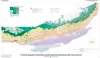
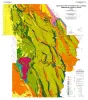
Structure Map of the San Antonio Segment of the Edwards Aquifer and Balcones Fault Zone, South-Central Texas: Structural Framework of a Major Limestone Aquifer: Kinney, Uvalde, Medina, Bexar, Comal, and Hays Counties | 1997 | Collins, E.W., Hovorka, S.D. | Miscellaneous Map | Bureau of Economic Geology | |
|
Tertiary and Quaternary structure and paleotectonics of the Hueco Basin, Trans-Pecos Texas and Chihuahua, Mexico | 1991 | The Hueco Basin of Trans-Pecos Texas, which formed in response to Cenozoic extensional tectonism, lies within the southern Rio Grande rift near the poorly defined boundary between the rift and the southern Basin and Range province. |
Collins, E.W., Raney, J.A. | Geological Circular | Bureau of Economic Geology |
|
Structural history and origin of the Sabine Arch, east Texas and northwest Louisiana | 1991 | The Sabine Arch is a large (1 2,000 mi2 [31,000 km2]), low-amplitude anticline centered on the Texas-Louisiana border. |
Jackson, M.L.W., Laubach, S.E. | Geological Circular | Bureau of Economic Geology |
|
Structural cross sections, Plio-Pleistocene series, southeastern Texas | 1989 | These cross sections illustrate the regional structure and stratigraphy beneath the Texas continental shelf . |
Morton, R.A., Jirik, L.A. | Cross Sections | Bureau of Economic Geology |
|
Regional structural cross sections, mid-Permian to Quaternary strata, Texas panhandle and eastern New Mexico: distribution of evaporites and areas of evaporite dissolution and collapse | 1988 | The Palo Duro Basin of the Texas Panhandle and eastern New Mexico contains bedded Permian salts of sufficient thickness and depth for the basin to be considered as a potential site for long-term storage and isolation of high-level nuclear waste. |
McGookey, D.A., Gustavson, T.C., Hoadley, A.D. | Cross Sections | Bureau of Economic Geology |
|
Structural geology of Sierra del Carmen, Trans-Pecos Texas | 1988 | Moustafa, A.R. | Geologic Quadrangle Map | Bureau of Economic Geology | |
|
Structure-contour map on the Lower Permian Red Cave Formation, Panhandle Field and adjacent areas of the Texas Panhandle | 1987 | Budnik, R.T. | Miscellaneous Map | Bureau of Economic Geology | |
|
Depositional and structural framework of the distal Frio Formation, Texas coastal zone and shelf | 1986 | Galloway, W.E. | Geological Circular | Bureau of Economic Geology | |

|
Structural cross sections, Miocene series, Texas continental shelf | 1985 | These cross sections numerically correspond to previously published onshore cross sections (CS0002--Dodge and Posey, 1981) and extend those sections across the continental shelf into the Miocene, a recent target of renewed petroleum exploration. |
Morton, R.A., Jirik, L.A., Foote, R.Q. | Cross Sections | Bureau of Economic Geology |