Atlases Publications
| Title | Publication Year Sort ascending | Abstract | Author | Series | Publisher | |
|---|---|---|---|---|---|---|
|
The Salt Mine: A Digital Atlas of Salt Tectonics | 2011 | This publication helps scientists quickly sort through the entire spectrum of knowledge of salt tectonics, isolate relevant information, and find pathways to more-detailed information. |
Hudec, M.R., Jackson, M.P.A. | Udden Series | Bureau of Economic Geology |
|
Atlas of northern Gulf of Mexico gas and oil reservoirs: Volume 1. Miocene and older reservoirs | 1997 | Seni, S.J., Hentz, T.F., Kaiser, W.R. | Atlases of Major Oil and Gas Reservoirs | Bureau of Economic Geology | |
|
Atlas of northern Gulf of Mexico gas and oil reservoirs: Volume 2. Pliocene and Pleistocene reservoirs | 1997 | Hentz, T.F., Seni, S.J., Wermund, E.G. | Atlases of Major Oil and Gas Reservoirs | Bureau of Economic Geology | |
|
Atlas of major Texas gas reservoirs | 1989 | In 1983, the Bureau of Economic Geology published the Atlas of Major Texas Oil Reservoirs, a precedent-setting synthesis of key geological and engineering data on 450 major oil reservoirs grouped into 48 regional plays. |
Kosters, E.C., Bebout, D.G., Seni, S.J., Garrett, C.M., Jr., Brown, L.F., Jr., Hamlin, H.S., Dutton, S.P., Ruppel, S.C. | Atlases of Major Oil and Gas Reservoirs | Bureau of Economic Geology |
|
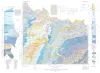
Geologic Atlas of Texas, Wichita Falls-Lawton sheet | 1987 | Geologic map that depicts the surface geology of Hardeman, Wilbarger, Wichita, Clay, Knox, Baylor, Archer, Haskell, Throckmorton, Young, and Foard Counties and part of Jack County, Texas. The 20-page booklet indicates geologic formations, abbreviations, and ages. |
Barnes, V.E., Hentz, T.F., Brown, L.F., Jr., Cleaves, A.W., Kier, R.S., McGowen, J.H., Parrish, W.C., Ramsey, J.W. | Geologic Atlas of Texas | Bureau of Economic Geology |

|
Bouguer gravity Atlas of Texas, Dalhart sheet | 1986 | This folded transparent map is at the same scale as its corresponding Geologic Atlas of Texas (GAT) sheet and can be superimposed on it to compare gravity information with surface geology. |
Keller, G.R., Aiken, C.L.V. | Bouguer Gravity Atlas of Texas | Bureau of Economic Geology |

|
Bouguer gravity Atlas of Texas, Hobbs sheet | 1986 | This folded transparent map is at the same scale as its corresponding Geologic Atlas of Texas (GAT) sheet and can be superimposed on it to compare gravity information with surface geology. |
Keller, G.R., Aiken, C.L.V. | Bouguer Gravity Atlas of Texas | Bureau of Economic Geology |

|
Bouguer gravity Atlas of Texas, Lubbock sheet | 1986 | This folded transparent map is at the same scale as its corresponding Geologic Atlas of Texas (GAT) sheet and can be superimposed on it to compare gravity information with surface geology. |
Keller, G.R., Aiken, C.L.V. | Bouguer Gravity Atlas of Texas | Bureau of Economic Geology |

|
Bouguer gravity Atlas of Texas, Perryton sheet | 1986 | This folded transparent map is at the same scale as its corresponding Geologic Atlas of Texas (GAT) sheet and can be superimposed on it to compare gravity information with surface geology. |
Keller, G.R., Aiken, C.L.V. | Bouguer Gravity Atlas of Texas | Bureau of Economic Geology |

|
Bouguer gravity Atlas of Texas, Plainview sheet | 1986 | This folded transparent map is at the same scale as its corresponding Geologic Atlas of Texas (GAT) sheet and can be superimposed on it to compare gravity information with surface geology. |
Keller, G.R., Aiken, C.L.V. | Bouguer Gravity Atlas of Texas | Bureau of Economic Geology |