|
Regional hydrodynamics and hydrochemistry of the uranium-bearing Oakville aquifer (Miocene) of south Texas |
Smith, G.E., Galloway, W.E., Henry, C.D., Gluck, J.K., McIntyre, J.F., Pisasale, E.T., Spradlin, S.D. |
1982 |
Report of Investigations |
|
Deltaic Sedimentation on the Louisiana Coast |
|
1982 |
Gulf Coast Section SEPM |

|
First Cretaceous Specimens of the Beryciform Fish Hoplopteryx from North America |
|
1982 |
Texas Memorial Museum |
|
Geology and geohydrology of the Palo Duro basin, Texas panhandle -- a report on the progress of nuclear waste isolation feasibility studies (1981), annual report for period October 1, 1980 - September 30, 1981 |
Gustavson, T.C., Bassett, R.L., Budnik, R.T., Finley, A.C., Goldstein, A.G., McGowen, J.H., Roedder, E., Ruppel, S.C., Baumgardner, R.W., Jr., Bentley, M.E., Dutton, S.P., Fogg, G.E., Hovorka, S.D., McGookey, D.A., Ramondetta, P.J., Simpkins, W.W., Smith, D., Smith, D.A., Duncan, E.A., Griffin, J.A., Merritt, R.M., Naiman, E.R. |
1982 |
Geological Circular |
|
Atoka Group (Lower to Middle Pennsylvanian), northern Fort Worth basin, Texas: terrigenous depositional systems, diagenesis, and reservoir distribution and quality |
Thompson, D.M. |
1982 |
Report of Investigations |

|
Fossil Mammals from the Lower Buck Hill Group, Eocene of Trans-Pecos Texas: |
|
1982 |
Texas Memorial Museum |
|
Considerations in the extraction of uranium from a fresh-water aquifer -- Miocene Oakville Sandstone, south Texas |
Henry, C.D., Galloway, W.E., Smith, G.E., Childs, C.S., Devine, P.E., Dutton, A.R., Gluck, J.K., McIntyre, J.F., Morton, J.P., Pisasale, E.T., Spradlin, S.D., Townsend, M.A. |
1982 |
Report of Investigations |
|
Occurrence of Exotic Fishes in Texas Waters |
|
1982 |
Texas Memorial Museum |
|
Ground-water hydraulics and hydrochemical facies in Eocene aquifers of the east Texas basin |
Fogg, G.E., Kreitler, C.W. |
1982 |
Report of Investigations |
|
Facies and stratigraphy of the San Andreas Formation, northern and northwestern shelves of the Midland basin, Texas and New Mexico |
Ramondetta, P.J., Guetzow, D.D., Dauzat, Rick, Merritt, R.M., Garza, John, Holman, Lee, Roques, Dominick |
1982 |
Report of Investigations |
|
Geology of the Plata Verde Mine, Hudspeth County, Texas |
Price, J.G. |
1982 |
Mineral Resource Circular |
|
Environmental geology of the Yegua - Jackson lignite belt, southeast Texas |
Jackson, M.L.W., Garner, L.E., Sharpe, R.D. |
1982 |
Report of Investigations |
|
GCAGS Transactions Volume 32 (1982) Houston |
|
1982 |
Gulf Coast Association of Geological Societies |
|
Annual Report of the Bureau of Economic Geology 1982 |
University of Texas at Austin, Bureau of Economic Geology |
1982 |
Annual Reports |
|
Depositional framework, hydrostratigraphy, and uranium mineralization of the Oakville Sandstone (Miocene), Texas coastal plain |
Galloway, W.E., Henry, C.D., Smith, G.E. |
1982 |
Report of Investigations |
|
The Vale Formation (Lower Permian): Its Vertebrates and Paleoecology |
|
1982 |
Texas Memorial Museum |
|
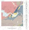
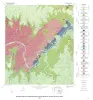
Geology of the Marble Falls quadrangle, Burnet and Llano Counties, Texas. |
Barnes, V.E. |
1982 |
Geologic Quadrangle Map |
|
The Mineral Industry of Texas in 1982 |
Ward, A.E. |
1982 |
Mineral Resource Circular |
|
Formation of the Wink Sink, a salt dissolution and collapse feature, Winkler County, Texas |
Baumgardner, R.W., Jr., Hoadley, A.D., Goldstein, A.G., Hummel, Gary, Young, D'nese, Sandstrom, M.A., Forman, J.L. |
1982 |
Report of Investigations |
|
Geology of the Pedernales Falls quadrangle, Blanco County, Texas |
Barnes, V.E. |
1982 |
Geologic Quadrangle Map |