|
Deep-Water Core Workshop, Northern Gulf of Mexico, 2002. CD-ROM |
|
2002 |
Gulf Coast Section SEPM |
|
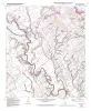
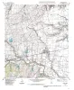
Geologic map of the Martindale quadrangle, Texas |
Collins, E.W. |
2002 |
Open-File Map |
|
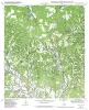
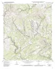
Geologic map of the Cypress Creek quadrangle, Texas |
Collins, E.W. |
2002 |
Open-File Map |
|
Petrography and diagenesis of a half-billion-year-old cratonic sandstone (Hickory), Llano region, Texas |
McBride, E.F., Abdel-Wahab, A.A., Milliken, K.L. |
2002 |
Report of Investigations |
|
Down to earth at Big Bend Ranch State Park, Texas: geologic map and trail-side geology |
Henry, C.D., Raney, J.A. |
2002 |
Down To Earth |
|
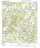
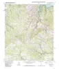
Geologic map of the Driftwood quadrangle, Texas |
Collins, E.W. |
2002 |
Open-File Map |
|
Seismic Sedimentology by Stratal Slicing--A Case History in the Mioceno Norte Area, Lake Maracaibo, Venezuela |
Zeng, Hongliu, Ambrose, W.A., Villalta, Edgar, Tyler, Roger |
2002 |
Report of Investigations |
|
Down to Earth at Mustang Island, Texas |
Raney, J.A., White, W.A. |
2002 |
Down To Earth |
|
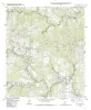
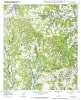
Geologic map of the Crabapple Creek quadrangle, Texas |
Collins, E.W. |
2002 |
Open-File Map |
|
Geologic map of the Dripping Springs quadrangle, Texas |
Collins, E.W. |
2002 |
Open-File Map |
|
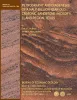
Geological controls on reservoir development in a Leonardian (Lower Permian) carbonate platform reservoir, Monahans field, West Texas |
Ruppel, S.C. |
2002 |
Report of Investigations |
|
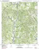
Geologic map of the Rafter Hollow quadrangle, Texas |
Collins, E.W. |
2002 |
Open-File Map |
|
Geologic map of the Hutto Quadrangle, Texas |
Collins, E.W. |
2002 |
Open-File Map |
|
Geologic map of the Rough Hollow quadrangle, Texas |
Collins, E.W. |
2002 |
Open-File Map |
|
Geologic map of the Shingle Hills quadrangle, Texas |
Collins, E.W. |
2002 |
Open-File Map |
|
Geologic map of the Whitworth Ranch quadrangle, Texas |
Collins, E.W. |
2002 |
Open-File Map |
|
Texas Geologist and the Bureau of Economic Geology, 1949-1970 |
Flawn, P.T. |
2002 |
Udden Series |
|
Geologic map of the McDade quadrangle, Texas |
Collins, E.W. |
2001 |
Open-File Map |
|
Austin and Beyond--Geology and Environment: A Field Excursion in Memory of L. Edwin Garner |
Woodruff, C.M., Jr., Collins, E.W. |
2001 |
Austin Geological Society |
|
GCAGS Transactions Volume 51 (2001) Shreveport |
|
2001 |
Gulf Coast Association of Geological Societies |