Publications in Upton
| Title | Publication Year Sort ascending | Abstract | Author | Series | Publisher | |
|---|---|---|---|---|---|---|
|
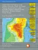
Upper Pennsylvanian and Lower Permian Shelf-to-Basin Facies Architecture and Trends, Eastern Shelf of the Southern Midland Basin, West Texas | 2017 | Our study documents the shelf, shelf-edge, slope, and basin-floor depositional facies characteristics, stratigraphic variations, and sedimentation trends of the Missourian Canyon Group and Virgilian–Wolfcampian Cisco Group across the southern Eastern Shelf and the adjacent Midland Basin. |
Hentz, T.F., Ambrose, W.A., Hamlin, H.S. | Report of Investigations | Bureau of Economic Geology |
|
Regional stratigraphic cross sections, Comanche Cretaceous (Fredericksburg - Washita Division), Edwards and Stockton plateaus, West Texas: interpretation of sedimentary facies, depositional cycles, and tectonics | 2000 | Six interlocking regional stratigraphic cross sections of Lower Cretaceous strata (middle Albian-lower Cenomanian) of the Edwards and Stockton Plateaus of West Texas illustrate the vertical and lateral extent of lithostratigraphic units and distribution of facies and facies tracts. |
Smith, C.I., Brown, J.B., Lozo, F.E. | Cross Sections | Bureau of Economic Geology |

|
Electrical Imaging Catalog: Microresistivity Images and Core Photos from Fractured, Karsted, and Brecciated Carbonates | 1997 | Electrical images in boreholes are becoming increasingly important in interpreting the rock record. |
Hammes, Ursula | Geological Circular | Bureau of Economic Geology |
|
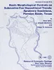
Basin morphological controls on submarine-fan depositional trends: Spraberry Sandstone, Permian Basin, Texas | 1997 | The Leonardian Spraberry Formation is a major oil-producing formation of the Permian Basin, accounting for more than 700 million barrels of oil produced from heterogeneous submarine-fan reservoirs. |
Tyler, Noel, Gholston, J.C., Guevara, E.H. | Geological Circular | Bureau of Economic Geology |
|
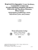
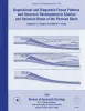
Depositional and diagenetic facies patterns and reservoir development in Silurian and Devonian rocks of the Permian basin | 1994 | Silurian and Devonian carbonate and chert rocks in the Permian Basin constitute a prolific hydrocarbon-bearing succession in West Texas and New Mexico. |
Ruppel, S.C., Holtz, M.H. | Report of Investigations | Bureau of Economic Geology |
|
Stratigraphic analysis of the Upper Devonian Woodford Formation, Permian Basin, West Texas and southeastern New Mexico | 1991 | The Upper Devonian Woodford Formation is an organic-rich petroleum source rock that extends throughout West Texas and southeastern New Mexico and currently is generating oil or gas in the subsurface. |
Comer, J.B. | Report of Investigations | Bureau of Economic Geology |
|
Integrated characterization of Permian Basin reservoirs, university lands, West Texas: targeting the remaining resource for advanced oil recovery | 1991 | Unrecovered mobile oil is oil that is movable at reservoir conditions but is prevented from migrating to existing we1 l bores because of geologic complexities or heterogeneities. |
Tyler, Noel, Bebout, D.G., Garrett, C.M., Jr., Guevara, E.H., Hocott, C.R., Holtz, M.H., Hovorka, S.D., Kerans, Charles | Report of Investigations | Bureau of Economic Geology |
|
Reservoir Modeling of Restricted Platform Carbonates: Geologic/Geostatistical Characterization of Interwell-Scale Reservoir Heterogeneity, Dune Field, Crane County, Texas | 1990 | Petroleum reservoirs typically yield only a fraction of the oil initially in place because geologic heterogeneity causes incomplete drainage of oil. |
Fogg, G.E., Lucia, F.J. | Report of Investigations | Bureau of Economic Geology |
|
Geological characterization of Permian submarine fan reservoirs of the Driver Waterflood Unit, Spraberry trend, Midland basin, Texas | 1988 | More than 350 well logs and core and production data were used to geologically characterize oil reservoirs of the Driver waterflood unit of the Spraberry Trend in the Midland Basin, West Texas, and to assess the relationship between reservoir stratigraphy and oil recovery. |
Guevara, E.H. | Report of Investigations | Bureau of Economic Geology |
|
Regional cross sections -- central basin platform, West Texas | 1985 | In 1982, the Bureau of Economic Geology initiated a project to characterize the major oil fields of Texas. |
Bebout, D.G., Meador, K.J. | Cross Sections |