Publications in Potter
| Title | Publication Year Sort ascending | Abstract | Author | Series | Publisher | |
|---|---|---|---|---|---|---|
|
Structure-contour map on the Lower Permian Red Cave Formation, Panhandle Field and adjacent areas of the Texas Panhandle | 1987 | Budnik, R.T. | Miscellaneous Map | Bureau of Economic Geology | |
|
Cyclicity in the Middle Permian San Andres Formation, Palo Duro Basin, Texas panhandle | 1986 | The San Andres Formation in the Palo Duro Basin is a middle Permian carbonate-evaporite sequence situated between two red-bed units, the underlying Glorieta and the overlying undifferentiated Queen-Grayburg sequences. |
Fracasso, M.A., Hovorka, S.D. | Report of Investigations | Bureau of Economic Geology |
|
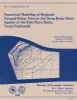
Numerical modeling of regional ground-water flow in the deep-basin brine aquifer of the Palo Duro Basin, Texas panhandle | 1986 | A conceptual hydrogeologic model of the Palo Duro Basin, Texas Panhandle, subdivides the basin into three hydrogeologic units: (1) the shallow Ogallala and Dockum aquifers (Upper aquifer), (2) the Permian evaporite aquitard (Evaporite aquitard), and (3) the deep, confined, underpressured, princip |
Wirojanagud, Prakob, Kreitler, C.W., Smith, D.A. | Report of Investigations | Bureau of Economic Geology |
|
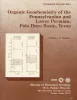
Organic geochemistry of the Pennsylvanian and Lower Permian, Palo Duro basin, Texas | 1986 | Cores from deep stratigraphic test wells provide an excellent basis for determination of source-rock quality and thermal maturity of potential hydrocarbon source rocks in the Palo Duro Basin. Total organic carbon (TOC) content in Pennsylvanian and Wolfcampian rocks is highest in basinal shales. |
Dutton, S.P. | Geological Circular | Bureau of Economic Geology |
|
Bouguer gravity Atlas of Texas, Amarillo sheet | 1986 | This folded transparent map is at the same scale as its corresponding Geologic Atlas of Texas (GAT) sheet and can be superimposed on it to compare gravity information with surface geology. |
Keller, G.R., Aiken, C.L.V. | Bouguer Gravity Atlas of Texas | Bureau of Economic Geology |
|
Bouguer gravity Atlas of Texas, Tucumcari sheet | 1986 | This folded transparent map is at the same scale as its corresponding Geologic Atlas of Texas (GAT) sheet and can be superimposed on it to compare gravity information with surface geology. |
Keller, G.R., Aiken, C.L.V. | Bouguer Gravity Atlas of Texas | Bureau of Economic Geology |
|
Investigation of underpressuring in the deep-basin brine aquifer, Palo Duro basin, Texas | 1985 | Although plots of pressure versus depth are useful for understanding the hydrodynamics of ground-water systems, they can be difficult to interpret. |
Orr, E.D., Kreitler, C.W., Senger, R.K. | Geological Circular | Bureau of Economic Geology |
|
Styles of deformation in Permian strata, Texas panhandle | 1984 | Permian strata in the Texas Panhandle exhibit a variety of deformation styles that are attributed to tectonic stresses as well as to collapse caused by evaporite dissolution. At Caprock Canyons State Park, deformation structures above salt dissolution zones include veins, faults, and folds. |
Collins, E.W. | Geological Circular | Bureau of Economic Geology |

|
Deep brine aquifers in the Palo Duro basin: regional flow and geochemical constraints | 1983 | Geologic characterization of evaporite deposits as potential host rocks for burial of radioactive waste must include hydrogeologic investigations at both local and regional scales. |
Bassett, R.L., Bentley, M.E., Duncan, E.A. | Report of Investigations | Bureau of Economic Geology |
|
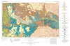
Geologic Atlas of Texas, Tucumcari sheet | 1983 | Geologic map that depicts the surface geology of Oldham County and parts of Hartley, Deaf Smith, Moore, Potter, and Randall Counties. |
Barnes, V.E., Eifler, G.K., Trauger, F.D., Spiegel, Z., Hawley, J.W., Dillon, R.L., Kottlowski, F.E., Hood, C. | Geologic Atlas of Texas | Bureau of Economic Geology |