|
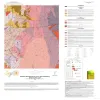
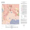
Bedrock Geologic Map of the Fly Gap Quadrangle, Mason County, Texas |
2025 |
|
Hunt, B.B., Helper, M.A., Droddy, Jr., M.J. |
Open-File Map |
Bureau of Economic Geology |

|
Geologic map of the Panther Creek quadrangle, Mason County, Texas |
2023 |
|
Hunt, B.B. |
Open-File Map |
Bureau of Economic Geology |

|
Geologic map of the Monument Mountain SE quadrangle, Mason County, Texas |
2023 |
|
Hunt, B.B. |
Open-File Map |
Bureau of Economic Geology |

|
Geologic map of the Mason Quadrangle, Mason County, Texas |
2022 |
|
Hunt, B.B., Johnson, B., Helper, M.A., Droxler, A. |
Open-File Map |
Bureau of Economic Geology |

|
Geologic map of the Turtle Creek Quadrangle, Mason County, Texas |
2022 |
|
Hunt, B.B., Johnson, B., Helper, M.A., Droxler, A. |
Open-File Map |
Bureau of Economic Geology |

|
Geologic map of the Grit quadrangle, Mason County, Texas |
2021 |
|
Hunt, B.B., Johnson, B., Helper, M.A. |
Open-File Map |
Bureau of Economic Geology |

|
Geologic map of the Katemcy quadrangle |
2020 |
|
Elliott, Brent A. |
Open-File Map |
Bureau of Economic Geology |

|
Geologic Map of the Pontotoc Quadrangle, Texas |
2017 |
|
Elliott, Brent A. |
Open-File Map |
Bureau of Economic Geology |

|
Geologic Map of the Fredonia Quadrangle, Texas |
2016 |
|
Elliott, Brent A. |
Open-File Map |
Bureau of Economic Geology |

|
Geologic map of the Spice Rock quadrangle, Texas |
2015 |
|
Elliott, Brent A. |
Open-File Map |
Bureau of Economic Geology |