Publications in Kenedy
| Title | Publication Year Sort ascending | Abstract | Author | Series | Publisher | |
|---|---|---|---|---|---|---|
|
Importance of Secondary Leached Porosity in Lower Tertiary Sandstone Reservoirs along the Texas Gulf Coast | 1980 | Secondary leached porosity is common to dominant in near surface to deep subsurface lower Tertiary sandstone reservoirs along the Texas Gulf Coast. This secondary porosity is in the form of leached feldspar grains, volcanic rock fragments, carbonate cements, and carbonate-replaced grains. |
Loucks, R.G., Dodge, M.M., Galloway, W.E. | Geological Circular | Bureau of Economic Geology |
|
Environmental geologic Atlas of the Texas coastal zone -- Brownsville-Harlingen area | 1980 | The Texas Coastal Zone is marked by diversity in geography, resources, climate, and industry. |
Brown, L.F., Jr., Brewton, J.L., Evans, T.J., McGowen, J.H., White, W.A., Groat, C.G., Fisher, W.L. | Environmental Geologic Atlas of the Texas Coastal Zone | Bureau of Economic Geology |
|
Sediment distribution, bathymetry, faults, and salt diapirs, submerged lands of Texas | 1979 | The State-owned submerged lands of Texas encompass nearly 6,000 square miles (15,540 km²) and extend from Mexico to Louisiana. The area includes the bays, estuaries, and lagoons, as well as the inner continental shelf 10.3 miles (16.6 km) seaward of the Gulf shoreline (fig. 1). |
McGowen, J.H., Morton, R.A. | Selected Reports | Bureau of Economic Geology |
|
Sandstone distribution and potential for geopressured geothermal energy production in the Vicksburg Formation along the Texas Gulf coast | 1979 | Potential geopressured geothermal reservoirs in the Vicksburg Formation are limited to Hidalgo County along the Lower Texas Gulf Coast. |
Loucks, R.G. | Geological Circular | Bureau of Economic Geology |
|
Environmental geologic Atlas of the Texas coastal zone -- Kingsville area | 1977 | The Texas Coastal Zone is marked by diversity in geography, resources, climate, and industry. |
Brown, L.F., Jr., McGowen, J.H., Evans, T.J., Groat, C.G., Fisher, W.L. | Environmental Geologic Atlas of the Texas Coastal Zone | Bureau of Economic Geology |
|
Shoreline changes on Mustang Island and North Padre Island (Aransas Pass to Yarborough Pass) -- an analysis of historical changes of the Texas Gulf shoreline | 1977 | Historical monitoring along Mustang and north Padre Islands records the nature and magnitude of changes in position of the shoreline and vegetation line and provides insight into the factors affecting those changes. |
Morton, R.A., Pieper, M.J. | Geological Circular | Bureau of Economic Geology |
|
Shoreline changes on central Padre Island (Yarborough Pass to Mansfield Channel) -- an analysis of historical changes of the Texas Gulf shoreline | 1977 | Historical monitoring along central Padre Island records the nature and magnitude of changes in position of the shoreline and vegetation line and provides insight into the factors affecting those changes. |
Morton, R.A., Pieper, M.J. | Geological Circular | Bureau of Economic Geology |

|
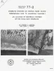
Historical Shoreline Changes and Their Causes, Texas Gulf Coast | 1977 | Sequential shoreline monitoring, using vintage chans and aerial photographs, documents temporal and spatial variations in historical Gulf shoreline changes. |
Morton, R.A. | Geological Circular | Bureau of Economic Geology |
|
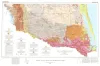
Geologic Atlas of Texas, McAllen-Brownsville sheet | 1976 | Geologic map that depicts surface geology of Starr, Hidalgo, Willacy, and Cameron Counties and parts of Zapata, Jim Hogg, Brooks, and Kenedy Counties. |
Barnes, V.E., Humble Oil and Refining Co., Shell Oil Co., Mobil Oil Co., Owens, Frith, Brewton, J.L., Aronow, Saul, Martin, R.G. | Geologic Atlas of Texas | Bureau of Economic Geology |
|
Geothermal Resources of the Texas Gulf Coast: Environmental Concerns Arising from the Production and Disposal of Geothermal Waters | 1976 | Disposal and temporary surface storage of spent geothermal fluids and surface subsidence and faulting are the major environmental problems that could arise from geopressured geothermal water production. |
Gustavson, T.C., Kreitler, C.W. | Geological Circular | Bureau of Economic Geology |