|
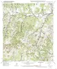
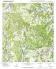
Geologic map of the Crabapple Creek quadrangle, Texas |
2002 |
|
Collins, E.W. |
Open-File Map |
Bureau of Economic Geology |
|
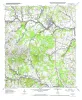
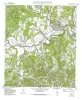
Geologic map of the Blanco quadrangle, Texas |
2002 |
|
Collins, E.W. |
Open-File Map |
Bureau of Economic Geology |
|
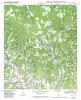
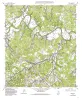
Geologic map of the Cypress Creek quadrangle, Texas |
2002 |
|
Collins, E.W. |
Open-File Map |
Bureau of Economic Geology |
|
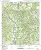
Geologic map of the Rafter Hollow quadrangle, Texas |
2002 |
|
Collins, E.W. |
Open-File Map |
Bureau of Economic Geology |
|
Geologic map of the Whitworth Ranch quadrangle, Texas |
2002 |
|
Collins, E.W. |
Open-File Map |
Bureau of Economic Geology |
|
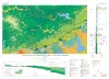
Geologic Map of the New Braunfels, Texas, 30x60 Minute Quadrangle |
2000 |
|
Collins, E.W. |
Miscellaneous Map |
Bureau of Economic Geology |
|
Geologic map of the Comfort quadrangle, Texas |
1995 |
|
Collins, E.W. |
Open-File Map |
Bureau of Economic Geology |
|
Geologic map of the Waring quadrangle, Texas |
1995 |
|
Collins, E.W. |
Open-File Map |
Bureau of Economic Geology |
|
Geologic map of the Turkey Knob quadrangle, Texas |
1995 |
|
Collins, E.W. |
Open-File Map |
Bureau of Economic Geology |
|
Geologic map of the Van Raub quadrangle, Texas |
1995 |
|
Collins, E.W. |
Open-File Map |
Bureau of Economic Geology |