Publications in Hemphill
| Title | Publication Year Sort ascending | Abstract | Author | Series | Publisher | |
|---|---|---|---|---|---|---|
|
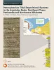
Pennsylvanian Tidal Depositional Systems in the Anadarko Basin, Northeast Texas Panhandle and Northwest Oklahoma | 2015 | A thick (>6,000-ft [>1,830-m]) succession of Desmoinesian to Virgilian (Pennsylvanian) strata in the northwest part of the Anadarko Basin contains a variety of tide-modified deposits. |
Ambrose, W.A., Tussey, L.B. | Report of Investigations | Bureau of Economic Geology |
|
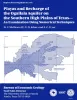
Playas and recharge of the Ogallala aquifer on the southern High Plains of Texas -- an examination using numerical techniques | 1997 | This study used a numerical model to examine the playa-focused recharge theory by comparing it with the spatially uniform approach and with a zonal approach. |
Mullican, W.F., Johns, N.D., Fryar, A.E. | Report of Investigations | Bureau of Economic Geology |
|
Depositional, structural, and sequence framework of the gas-bearing Cleveland Formation (Upper Pennsylvanian), western Anadarko basin, Texas panhandle | 1994 | ow-permeability ("tight") reservoir sandstones of the lower Missourian Cleveland formation produced more than 435 billion cubic feet (Bcf) of natural gas through December 1990, mostly from Ochiltree and Lipscomb Counties in the northeastern Texas Panhandle. |
Hentz, T.F. | Report of Investigations | Bureau of Economic Geology |
|
Tertiary and Quaternary stratigraphy and vertebrate paleontology of parts of northwestern Texas and eastern New Mexico | 1990 | This field guide summarizes recent interpretations of the upper Cenozoic stratigraphy of parts of the Southern High Plains and Rolling Plains in northwestern Texas and eastern New Mexico. |
Gustavson, T.C., Holliday, V.T., Osterkamp, W.R., Schultz, G.E., Winkler, D.A. | Guidebook | Bureau of Economic Geology |
|
Geologic Significance of Remotely Sensed Physiographic Features of the Texas Panhandle and Adjacent Regions | 1990 | Remotely sensed features such as linear drainages, escarpments, ridges, and aligned playas have been identified on Landsat imagery (scale 1:250,000) of the Texas Panhandle and adjacent regions to allow comparison of these features with detailed regional and site-specific geologic data. |
Collins, E.W. | Geological Circular | Bureau of Economic Geology |

|
Hydrogeology and hydrochemistry of the Ogallala aquifer, southern High Plains, Texas panhandle and eastern New Mexico | 1988 | The Ogallala aquifer, which underlies the Southern High Plains, consists of the saturated sediments of the Neogene Ogallala Formation. The aquifer is the main source of water for the High Plains of Texas and New Mexico and is being severely depleted by extensive pumpage for irrigation. |
Nativ, Ronit | Report of Investigations | Bureau of Economic Geology |
|
Bouguer gravity Atlas of Texas, Amarillo sheet | 1986 | This folded transparent map is at the same scale as its corresponding Geologic Atlas of Texas (GAT) sheet and can be superimposed on it to compare gravity information with surface geology. |
Keller, G.R., Aiken, C.L.V. | Bouguer Gravity Atlas of Texas | Bureau of Economic Geology |
|
Bouguer gravity Atlas of Texas, Perryton sheet | 1986 | This folded transparent map is at the same scale as its corresponding Geologic Atlas of Texas (GAT) sheet and can be superimposed on it to compare gravity information with surface geology. |
Keller, G.R., Aiken, C.L.V. | Bouguer Gravity Atlas of Texas | Bureau of Economic Geology |
|
Geology and geohydrology of the Palo Duro basin, Texas panhandle -- a report on the progress of nuclear waste isolation feasibility studies (1981), annual report for period October 1, 1980 - September 30, 1981 | 1982 | Integrated study of the basin structure, tectonic history, rock physics, physical stratigraphy, hydrogeology, geochemistry, natural resources, and geomorphology of the Palo Duro and Dalhart Basins in the Texas Panhandle is part of a national evaluation of ancient salt basins as potential sites fo |
Gustavson, T.C., Bassett, R.L., Budnik, R.T., Finley, A.C., Goldstein, A.G., McGowen, J.H., Roedder, E., Ruppel, S.C. | Geological Circular | Bureau of Economic Geology |
|
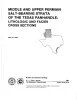
Middle and Upper Permian salt-bearing strata of the Texas panhandle: lithologic and facies cross sections | 1981 | Regional cross sections of Middle and Upper Permian rocks in the Texas Panhandle illustrate the lithology, depositional systems, and structure of these salt-bearing strata. |
Presley, M.W. | Cross Sections | Bureau of Economic Geology |