|
Pavement Deflection and Seismic Refraction for Determining Bedrock Type, Depth, and Physical Properties beneath Roads |
2000 |
We examined the relationship between three data types--geologic maps, measurements of pavement deflection under load, and seismic refraction data-- from diverse geologic settings in Texas to determine (1) whether geologic maps and seismic refraction data might be used to interpret deflections and |
Paine, J.G., Murphy, M.R. |
Report of Investigations |
Bureau of Economic Geology |
|
Permeability structure of the Edwards aquifer, south Texas -- implications for aquifer management |
1998 |
This report describes the three-dimensional distribution of hydraulic conductivity in the Edwards aquifer from Kinney to Comal Counties, Texas. |
Hovorka, S.D., Mace, R.E., Collins, E.W. |
Report of Investigations |
Bureau of Economic Geology |
|
Structure Map of the San Antonio Segment of the Edwards Aquifer and Balcones Fault Zone, South-Central Texas: Structural Framework of a Major Limestone Aquifer: Kinney, Uvalde, Medina, Bexar, Comal, and Hays Counties |
1997 |
|
Collins, E.W., Hovorka, S.D. |
Miscellaneous Map |
Bureau of Economic Geology |
|
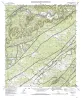
Geologic map of the Devil's Backbone Quadrangle, Texas |
1991 |
|
Collins, E.W. |
Open-File Map |
Bureau of Economic Geology |
|
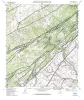
Geologic map of the Wimberley Quadrangle, Texas |
1991 |
|
Collins, E.W., Baumgardner, R.W., Jr., Raney, J.A. |
Open-File Map |
Bureau of Economic Geology |
|
Geologic map of the Hunter Quadrangle, Texas |
1991 |
|
Baumgardner, R.W., Jr., Collins, E.W. |
Open-File Map |
Bureau of Economic Geology |
|
The Guadalupe - Lavaca - San Antonio - Nueces River basins regional study: San Antonio East - Llano East sheets |
1985 |
|
Wermund, E.G., Gustavson, T.C., Garner, L.E., Morton, R.A., Woodruff, C.M., Jr., Macpherson, G.L., McKinney, L., Nilsson, J. |
River Basins Regional Studies |
Bureau of Economic Geology |
|
The Guadalupe - Lavaca - San Antonio - Nueces River basins regional study: Seguin West - Austin West sheets |
1985 |
|
Wermund, E.G., Gustavson, T.C., Morton, R.A., Woodruff, C.M., Jr., Macpherson, G.L., McKinney, L., Nilsson, J., Waddell, C.T. |
River Basins Regional Studies |
Bureau of Economic Geology |
|
Hydrogeology of the Edwards aquifer, Austin area, central Texas |
1984 |
The Edwards Formation, on the downthrown side of Mt. Bonnell fault in the Austin, Texas, area (Hays and Travis Counties), is part of the northeastern extension of the Edwards Underground Reservoir, the primary source of water in numerous counties along the Balcones Fault Zone. |
Senger, R.K., Kreitler, C.W. |
Report of Investigations |
Bureau of Economic Geology |
|
Hydrogeology of Edwards Aquifer-Barton Springs Segment, Travis and Hays Counties, Texas |
1984 |
|
Woodruff, C.M., Jr., Slade, Raymond M., Jr. |
Austin Geological Society |
Austin Geological Society |