Publications in Edwards
| Title | Publication Year Sort ascending | Abstract | Author | Series | Publisher | |
|---|---|---|---|---|---|---|
|
Regional stratigraphic cross sections, Comanche Cretaceous (Fredericksburg - Washita Division), Edwards and Stockton plateaus, West Texas: interpretation of sedimentary facies, depositional cycles, and tectonics | 2000 | Six interlocking regional stratigraphic cross sections of Lower Cretaceous strata (middle Albian-lower Cenomanian) of the Edwards and Stockton Plateaus of West Texas illustrate the vertical and lateral extent of lithostratigraphic units and distribution of facies and facies tracts. |
Smith, C.I., Brown, J.B., Lozo, F.E. | Cross Sections | Bureau of Economic Geology |
|
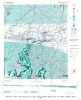
Geologic map of the Flat Rock Creek SW quadrangle, Texas | 1999 | Collins, E.W. | Open-File Map | Bureau of Economic Geology | |
|
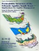
Permeability structure of the Edwards aquifer, south Texas -- implications for aquifer management | 1998 | This report describes the three-dimensional distribution of hydraulic conductivity in the Edwards aquifer from Kinney to Comal Counties, Texas. |
Hovorka, S.D., Mace, R.E., Collins, E.W. | Report of Investigations | Bureau of Economic Geology |
|
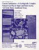
Canyon sandstones -- a geologically complex natural gas play in slope and basin facies, Val Verde basin, southwest Texas | 1995 | Canyon sandstones form a prolific low-permeability gas play in the Val Verde Basin of southwest Texas. Exploration and development activity is at a high level, but little published information on Canyon geology is available. |
Hamlin, H.S., Clift, S.J., Dutton, S.P., Hentz, T.F., Laubach, S.E. | Report of Investigations | Bureau of Economic Geology |
|
Geology of the Carta Valley fault zone area: Edwards, Kinney, and Val Verde Counties, Texas | 1982 | Webster, R.E. | Geologic Quadrangle Map | Bureau of Economic Geology | |
|
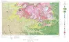
Geologic Atlas of Texas, Llano sheet | 1981 | Geologic map that depicts the surface geology of Mason, Llano, and Gillespie Counties and parts of Menard, Kimble, San Saba, McCulloch, Edwards, Real, Kerr, Kendall, Blanco, Hays, Travis, Williamson, and Burnet Counties, Texas. |
Barnes, V.E., Shell Oil Co., Boyer, R.E., Clabaugh, S.E., Baker, E.T. | Geologic Atlas of Texas | Bureau of Economic Geology |
|
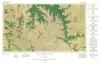
Geologic Atlas of Texas, Sonora sheet | 1981 | Geologic map that depicts the surface geology of Sutton County and parts of Terrell, Crockett, Val Verde, Edwards, Kimble, Menard, Schleicher, and Pecos Counties. |
Barnes, V.E., McKalips, D.G., Cities Service Petroleum Co., Geophoto Services Inc., Stump, R.W., Brown, J.B., Pearson, B.T., Volkmann, R.G. | Geologic Atlas of Texas | Bureau of Economic Geology |
|
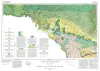
Geologic Atlas of Texas, Del Rio sheet | 1977 | Geologic map that depicts surface geology of Kinney County and parts of Terrell, Val Verde, Edwards, Real, Uvalde, and Maverick Counties, Texas. |
Barnes, V.E., Waechter, N.B., Pinkley, G.R., Martin, R.G., Wyeth, J.C., Knupke, J.A., Sulik, J.F., Ellis, W.G. | Geologic Atlas of Texas | Bureau of Economic Geology |
|
Mineral resources of south Texas: region served through the port of Corpus Christi | 1962 | This report is a compilation of all available data on mineral resources (exclusive of oil and gas) in 39 south Texas counties. Information from published and unpublished sources was checked and supplemented by field investigations. |
Maxwell, R.A. | Report of Investigations | Bureau of Economic Geology |
|
Record of Peterson Well in Edwards County Texas | 1929 | These circulars issued from the Bureau of Economic Geology contain the record of cores and cuttings from well received and described in the Bureau. |
Well Record |