Publications by White, W.A.
| Title | Publication Year Sort ascending | Abstract | Author | Series | Publisher | |
|---|---|---|---|---|---|---|
|
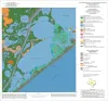
Geoenvironmental map of the Christmas Point quadrangle, Texas | 2004 | Tremblay, T.A., White, W.A., Waldinger, R.L., Collins, E.W. | Open-File Map | Bureau of Economic Geology | |
|
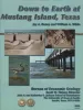
Down to Earth at Mustang Island, Texas | 2002 | Beautifully illustrated by more than 100 photos and diagrams, this nontechnical guide surveys the geologic evolution of Mustang Island and the relationship between physical setting and biologic environments along the Texas coast. |
Raney, J.A., White, W.A. | Down To Earth | Bureau of Economic Geology |
|
Atlas of Major Midcontinent Gas Reservoirs | 1993 | Bebout, D.G., White, W.A., Hentz, T.F., Grasmick, M.K. | Atlases of Major Oil and Gas Reservoirs | Bureau of Economic Geology | |
|
Atlas of Major Central and Eastern Gulf Coast Gas Reservoirs | 1992 | The Atlas of Major Central and Eastern Gulf Coast Gas Reservoirs is the second in a series compiling geologic and engineering data on natural gas reservoirs in the major gas-producing regions of the United States. |
Bebout, D.G., White, W.A., Garrett, C.M., Jr., Hentz, T.F. | Atlases of Major Oil and Gas Reservoirs | Bureau of Economic Geology |
|
Submerged lands of Texas, Kingsville area: sediments, geochemistry, benthic macroinvertebrates, and associated wetlands | 1989 | The State-owned submerged lands of Texas encompass almost 6,000 mi2 (15,540 km2). They lie below waters of the bay-estuary-lagoon system and the Gulf of Mexico and extend 10.3 mi (16.6 km) seaward from the Gulf shoreline (fig. 1). |
White, W.A., Calnan, T.R., Morton, R.A., Kimble, R.S., Littleton, T.G., McGowen, J.H., Nance, H.S. | Submerged Lands of Texas | Bureau of Economic Geology |
|
Submerged lands of Texas, Port Lavaca area: sediments, geochemistry, benthic macroinvertebrates, and associated wetlands | 1989 | The State-owned submerged lands of Texas encompass almost 6,000 mi2 (15,540 km2). They lie below waters of the bay-estuary-lagoon system and the Gulf of Mexico and extend 10.3 mi (16.6 km) seaward from the Gulf shoreline (fig. 1). |
White, W.A., Calnan, T.R., Morton, R.A., Kimble, R.S., Littleton, T.G., McGowen, J.H., Nance, H.S. | Submerged Lands of Texas | Bureau of Economic Geology |
|
Submerged lands of Texas, Bay City - Freeport area: sediments, geochemistry, benthic macroinvertebrates, and associated wetlands | 1988 | The State-owned submerged lands of Texas encompass almost 6,000 mi2 (15,540 km2). They lie below waters of the bay-estuary-lagoon system and the Gulf of Mexico and extend 10.3 mi (16.6 km) seaward from the Gulf shoreline (fig. 1). |
White, W.A., Calnan, T.R., Morton, R.A., Kimble, R.S., Littleton, T.G., McGowen, J.H., Nance, H.S. | Submerged Lands of Texas | Bureau of Economic Geology |
|
Submerged lands of Texas, Beaumont - Port Arthur area: sediments, geochemistry, benthic macroinvertebrates, and associated wetlands | 1987 | The State-owned submerged lands of Texas encompass almost 6,000 mi2 (15,540 km2). They lie below waters of the bay-estuary-lagoon system and the Gulf of Mexico and extend 10.3 mi (16.6 km) seaward from the Gulf shoreline (fig. 1). |
White, W.A., Calnan, T.R., Morton, R.A., Kimble, R.S., Littleton, T.G., McGowen, J.H., Nance, H.S. | Submerged Lands of Texas | Bureau of Economic Geology |
|
Historical shoreline changes in San Antonio, Espiritu Santo, and Mesquite Bays, Texas Gulf coast | 1987 | Changes in the position and stability of shorelines in the San Antonio Bay system (San Antonio, Espiritu Santo, and Mesquite Bays), Texas Gulf Coast, were documented using historical monitoring techniques. |
White, W.A., Morton, R.A. | Geological Circular | Bureau of Economic Geology |
|
Submerged lands of Texas, Brownsville - Harlingen area: sediments, geochemistry, benthic macroinvertebrates, and associated wetlands | 1986 | The State-owned submerged lands of Texas encompass almost 6,000 mi2 (15,540 km2). They lie below waters of the bay-estuary-lagoon system and the Gulf of Mexico and extend 10.3 mi (16.6 km) seaward from the Gulf shoreline (fig. 1). |
White, W.A., Calnan, T.R., Morton, R.A., Kimble, R.S., Littleton, T.G., McGowen, J.H., Nance, H.S., Schmedes, K.E. | Submerged Lands of Texas | Bureau of Economic Geology |